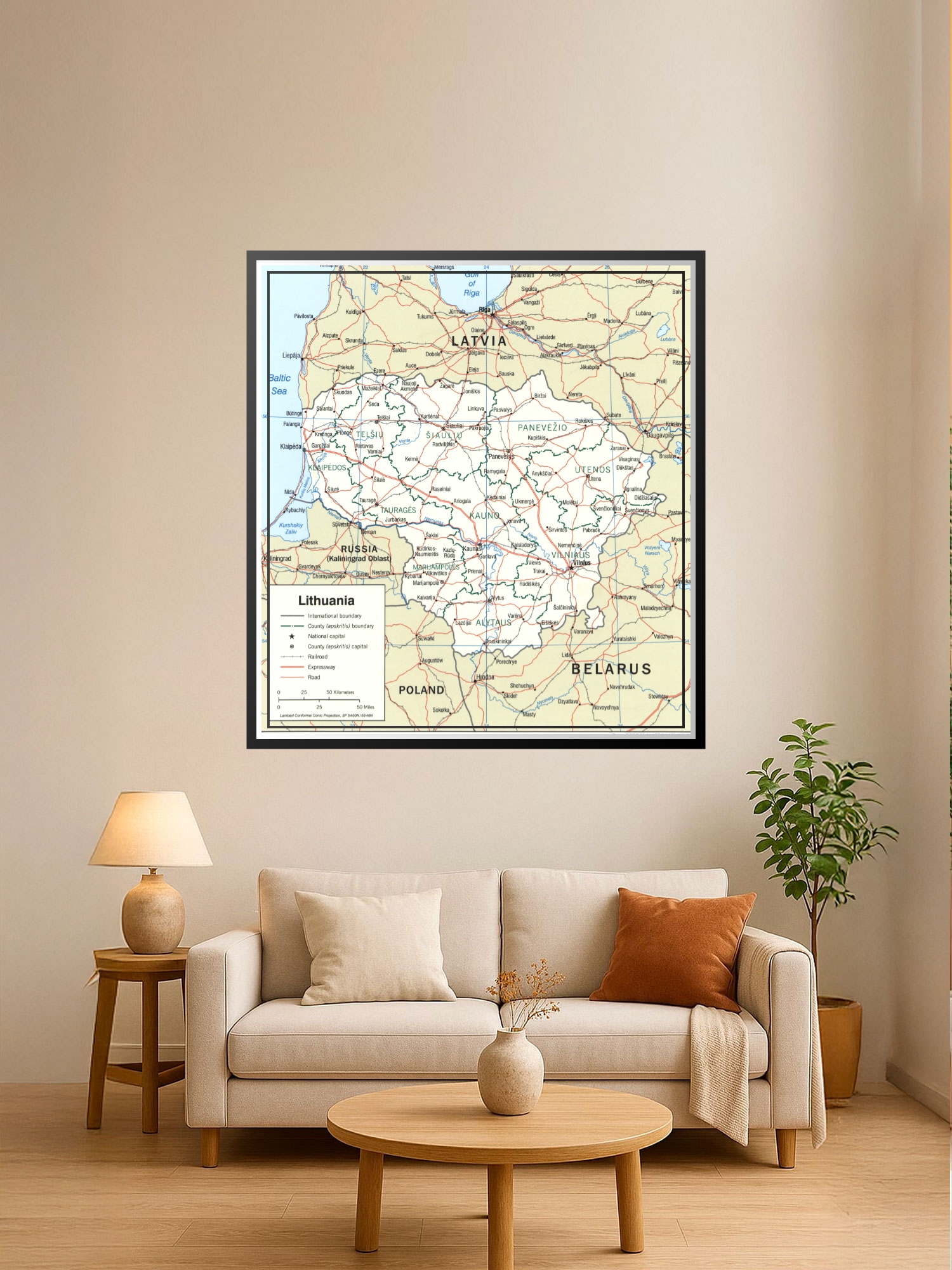
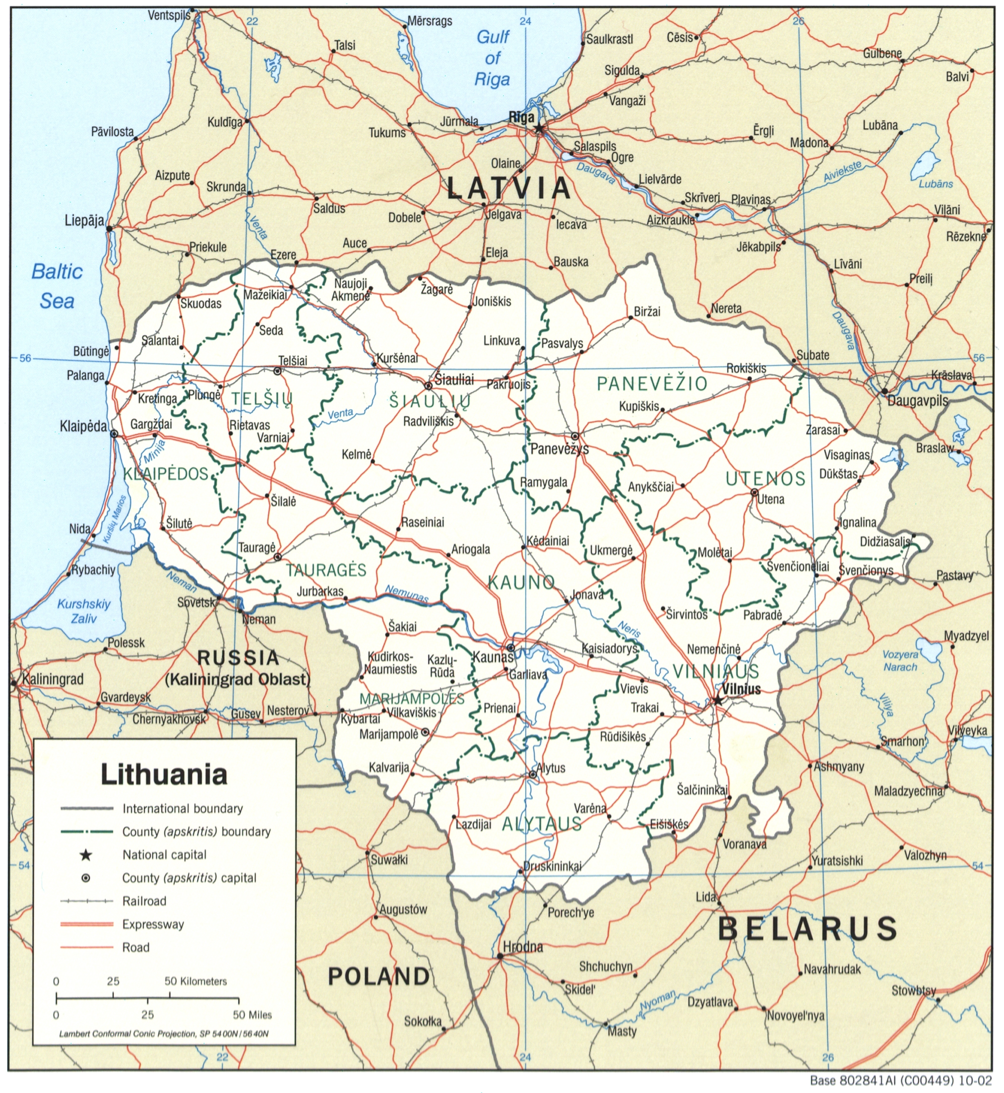
Political Map of Lithuania Poster – Geographic Reference Wall Art | Gift Ideas

| Weight | 8 oz |
|---|---|
| Dimensions | 26 × 2 × 2 in |
| Size (inches) | |
| Finishing Options |
Political Map of Lithuania Poster – Geographic Reference Wall Art | Gift Ideas
This detailed political map of Lithuania showcases the country’s international boundaries, regional divisions, major cities, and transportation networks with clarity and precision. The map features distinct color-coding for county borders, railway lines, expressways, and roads, making it both an educational resource and a striking wall display. Perfect for classrooms, home offices, travel enthusiasts, and anyone with a connection to Lithuania or Eastern European geography. The cartographic design combines functional accuracy with clean, readable typography that works beautifully in study spaces, libraries, and living rooms. Printed on archival-grade paper with fade-resistant inks, this poster is ready to frame and brings geographic knowledge into your decor.
Available Finishes
- A classic, high-quality poster print with crisp detail and solid color.
- Ideal for everyday wall art, dorms, offices, and framing behind glass.
- Great choice when you want a traditional poster look at a good value.
- Sealed with a protective laminate layer for added strength and wipe-clean protection.
- Resists moisture, fingerprints, and scuffs.
- Great for high-traffic areas, classrooms, shops, and break rooms.
How to Choose the Right Finish for Your Map
similar maps
Reviews
There are no reviews yet.