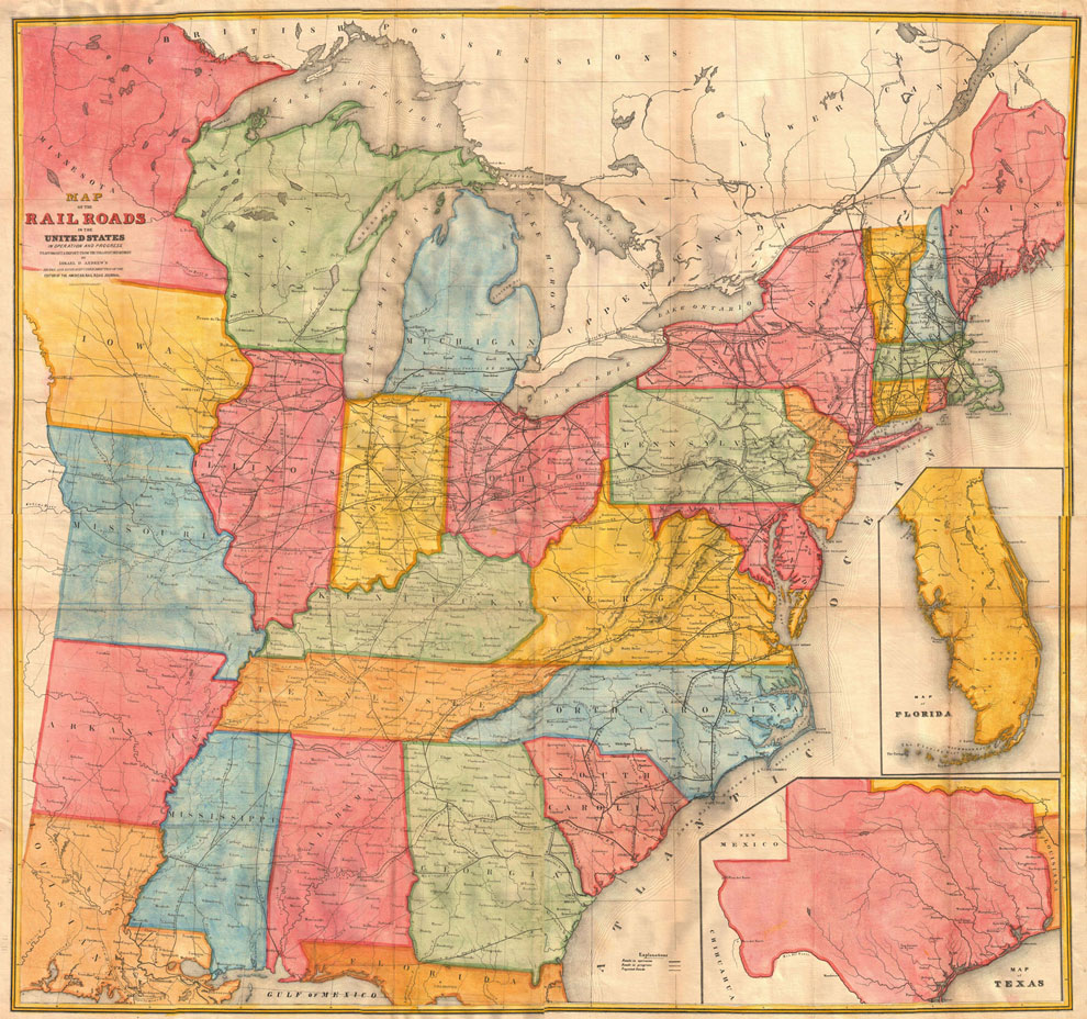
Andrews Railroad. Maps of USA Geographicus -1852 Map Poster
| Weight | 6 oz |
|---|---|
| Dimensions | 20 × 2 × 2 in |
| Finishing Options | |
| Brand Name | |
| Size (inches) |
Andrews Railroad. Maps of USA Geographicus -1852 Map Poster
Andrews Railroad. Maps of USA Geographicus -1852 Map Poster is designed for customers who want map wall art with detail, history and a polished decor feel. Based on Andrews Railroad. Maps of USA Geographicus -1852 Map, this historical map print works beautifully as office decor, classroom art, study-room wall art or a gift for geography and travel enthusiasts. The design pairs well with vintage posters, travel prints and educational wall decor. Available options are shown on this product page. Frame not included.
Andrews Railroad. Maps of USA Geographicus -1852 Map map poster with historical map character, ideal for offices, classrooms, libraries, studies and.
How to Choose the Right Finish for Your Map
Reviews
There are no reviews yet.