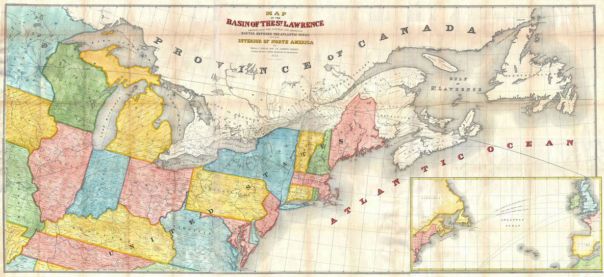
Rare Vintage and Modern Maps Andrews Map of the Great Lakes and St. Lawrence Basin – Geographicus-1853 Routs Between the Atlantic Ocean Poster
| Weight | 6 oz |
|---|---|
| Dimensions | 20 × 2 × 2 in |
| Finishing Options | |
| Brand Name | |
| Size (inches) |
Rare Vintage and Modern Maps Andrews Map of the Great Lakes and St. Lawrence Basin – Geographicus-1853 Routs Between the Atlantic Ocean Poster
Rare Vintage and Modern Maps Andrews Map of the Great Lakes and St. Lawrence Basin – Geographicus-1853 Routs Between the Atlantic Ocean Poster features a carefully selected historical map design for collectors, travelers, students and map lovers. The artwork highlights Rare Vintage and Modern Maps Andrews Map of the Great Lakes and St. with a clean presentation that works well in offices, classrooms, libraries, studies and gallery walls. This map print is a strong choice for educational decor, geography-inspired interiors or anyone who enjoys detailed cartographic wall art. Choose from the available size and finish options shown on this page. Frame not included.
Rare Vintage and Modern Maps Andrews Map of the Great Lakes map poster with historical map character, ideal for offices, classrooms, libraries, studies and.
How to Choose the Right Finish for Your Map
Nolik –
cool map! canvas option looks great on my wall.