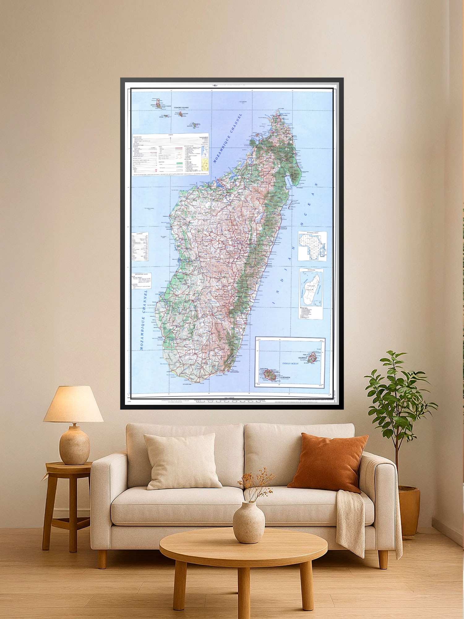
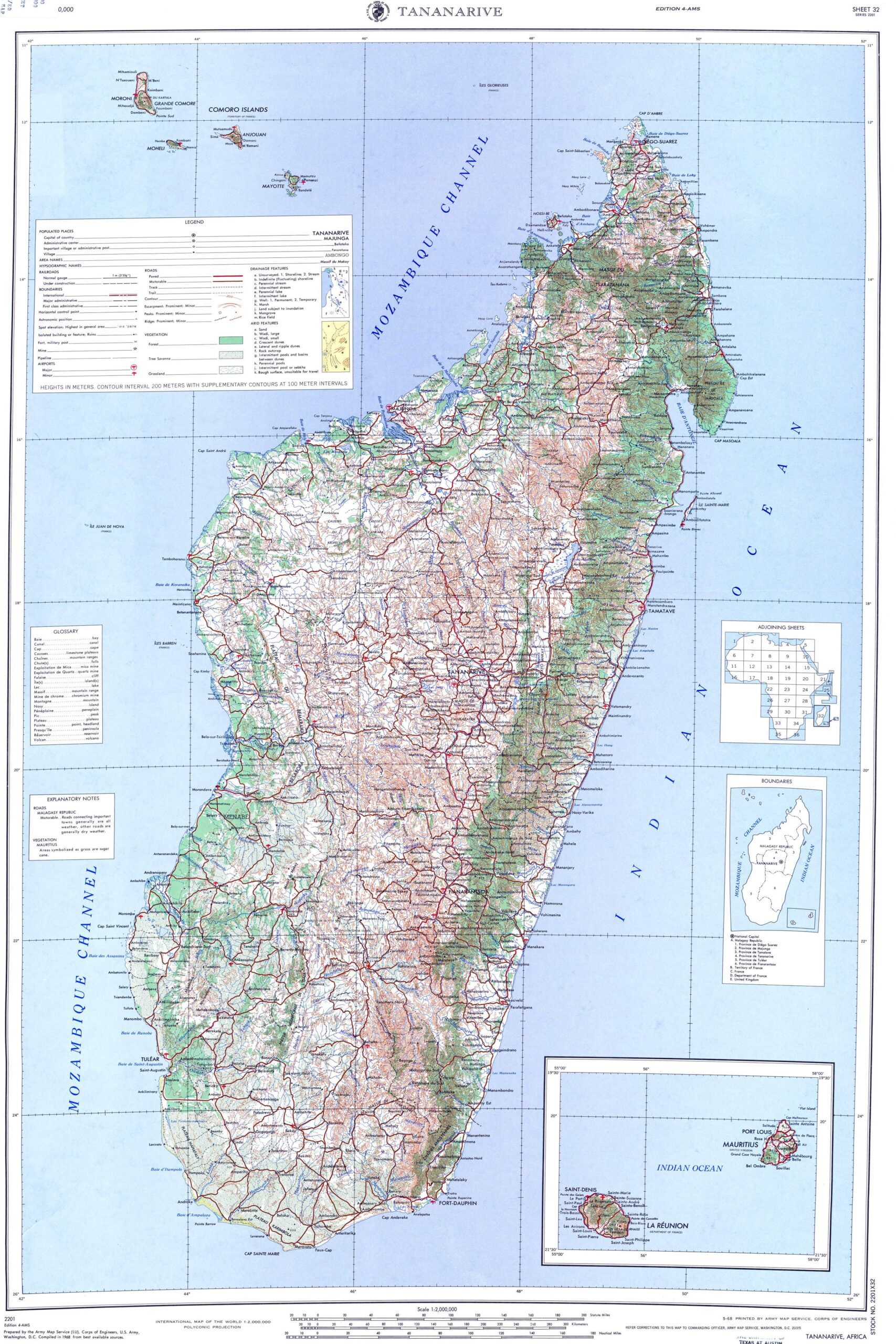
Topographic Map of Madagascar Poster – Detailed Geographic Wall Art | Travel & Education

| Weight | 8 oz |
|---|---|
| Dimensions | 26 × 2 × 2 in |
| Size (inches) | |
| Finishing Options |
Topographic Map of Madagascar Poster – Detailed Geographic Wall Art | Travel & Education
Explore the island nation of Madagascar with this comprehensive political map poster, featuring detailed regional boundaries, cities, towns, and geographic landmarks across the entire island. The cartographic design combines soft blues for ocean waters with green and pink regional divisions, making it both educational and visually engaging for any wall. Perfect for classrooms, home offices, travel enthusiasts, and geography lovers who appreciate authentic map cartography. This poster serves as both a learning tool and a conversation-starting piece that brings world geography into focus. Printed on archival-grade paper with fade-resistant inks, ready to frame and display.
Available Finishes
- A classic, high-quality poster print with crisp detail and solid color.
- Ideal for everyday wall art, dorms, offices, and framing behind glass.
- Great choice when you want a traditional poster look at a good value.
- Sealed with a protective laminate layer for added strength and wipe-clean protection.
- Resists moisture, fingerprints, and scuffs.
- Great for high-traffic areas, classrooms, shops, and break rooms.
How to Choose the Right Finish for Your Map
similar maps

Reviews
There are no reviews yet.