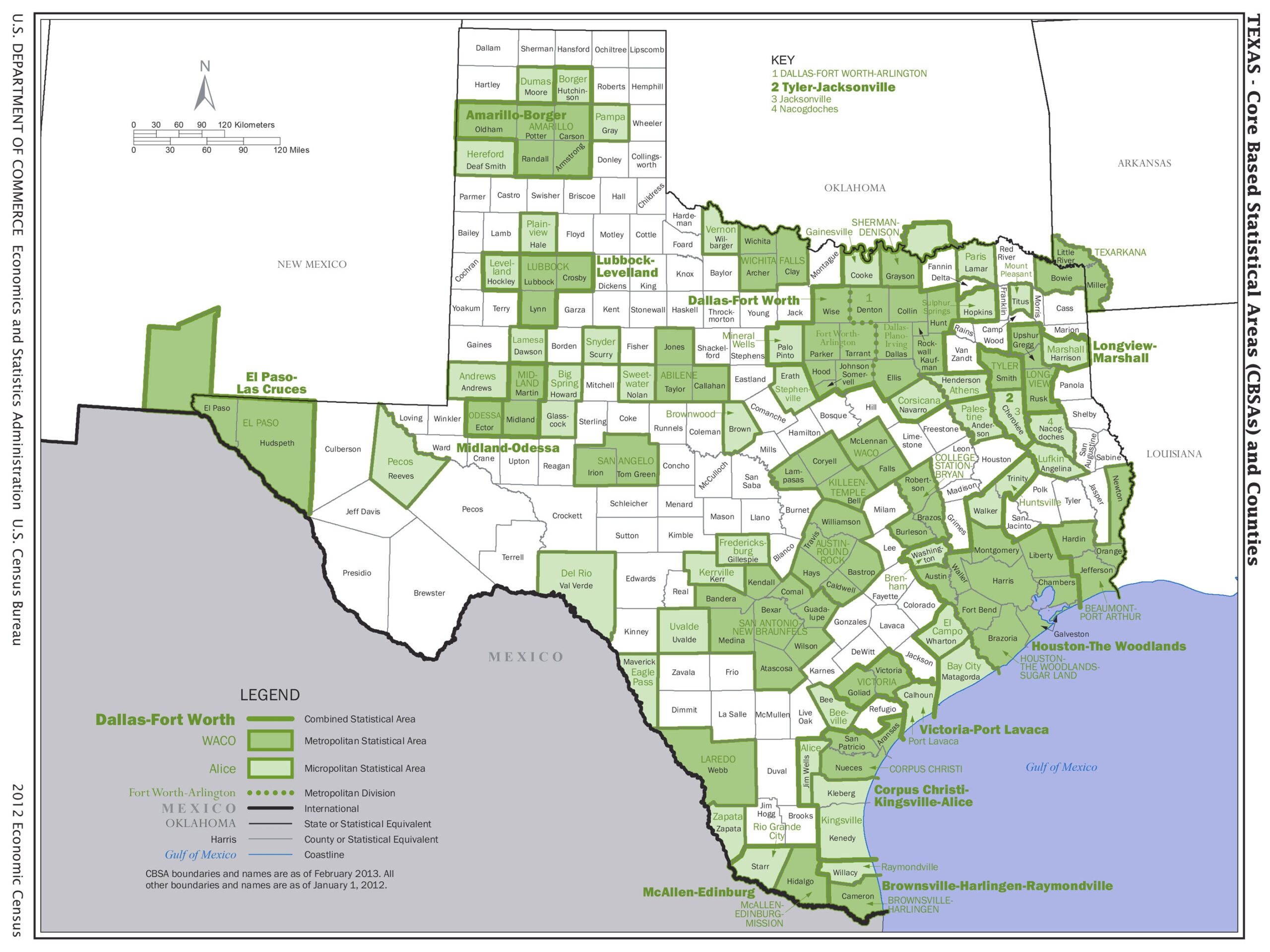
Texas Core Based Statistical Areas Map Poster – Detailed County & Metro Region Overview
| Weight | 8 oz |
|---|---|
| Dimensions | 26 × 2 × 2 in |
| Size (inches) | |
| Finishing Options |
Texas Core Based Statistical Areas Map Poster – Detailed County & Metro Region Overview
Add a refined map print to your wall with Texas Core Based Statistical Areas Map Poster – Detailed County & Metro Region Overview. The design focuses on Texas Core Based Statistical Areas Map, giving the poster a strong sense of place and cartographic detail. It is well suited for offices, schools, libraries, dens, studios and gallery walls where geography, history or travel decor feels at home. Choose from the available finishes and sizes listed above. Frame not included.
Texas Core Based Statistical Areas Map map poster with railroad and transit map character, ideal for offices, classrooms, libraries, studies and.
How to Choose the Right Finish for Your Map
Reviews
There are no reviews yet.