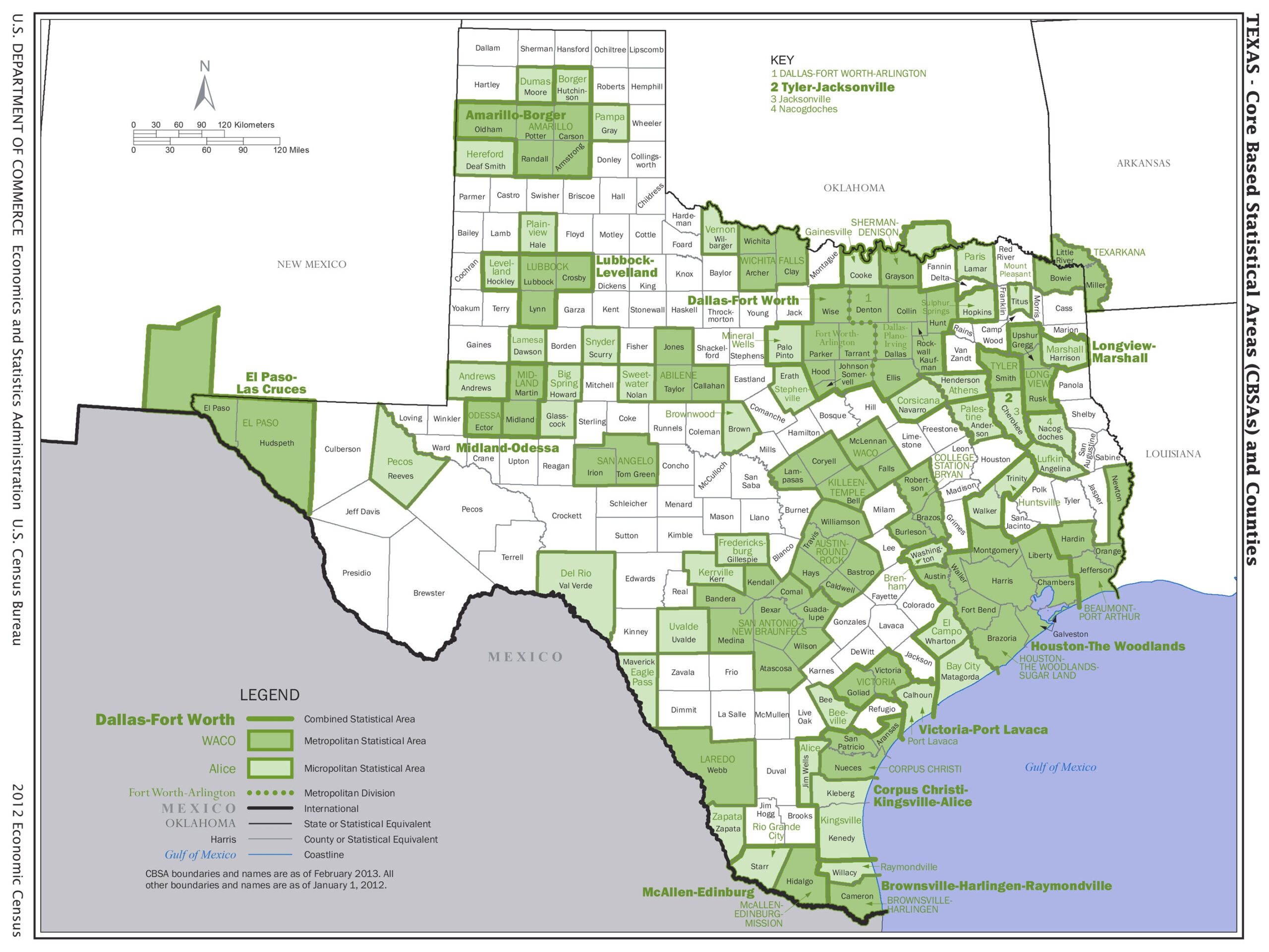
Texas Core Based Statistical Areas Map Poster – Detailed County & Metro Region Overview

| Weight | 8 oz |
|---|---|
| Dimensions | 26 × 2 × 2 in |
| Size (inches) | |
| Finishing Options |
Texas Core Based Statistical Areas Map Poster – Detailed County & Metro Region Overview
Explore the demographic and economic layout of Texas with this professionally designed Texas Core Based Statistical Areas (CBSA) Map Poster. Featuring updated U.S. Census Bureau classifications, this map displays metropolitan and micropolitan regions in vivid green tones, along with labeled counties, state boundaries, and major urban hubs like Dallas-Fort Worth, Houston, and El Paso. Perfect for educators, analysts, or anyone with a passion for geography, urban planning, or Texas history, this high-resolution print is ideal for classrooms, offices, or home decor.
How to Choose the Right Finish for Your Map

Reviews
There are no reviews yet.