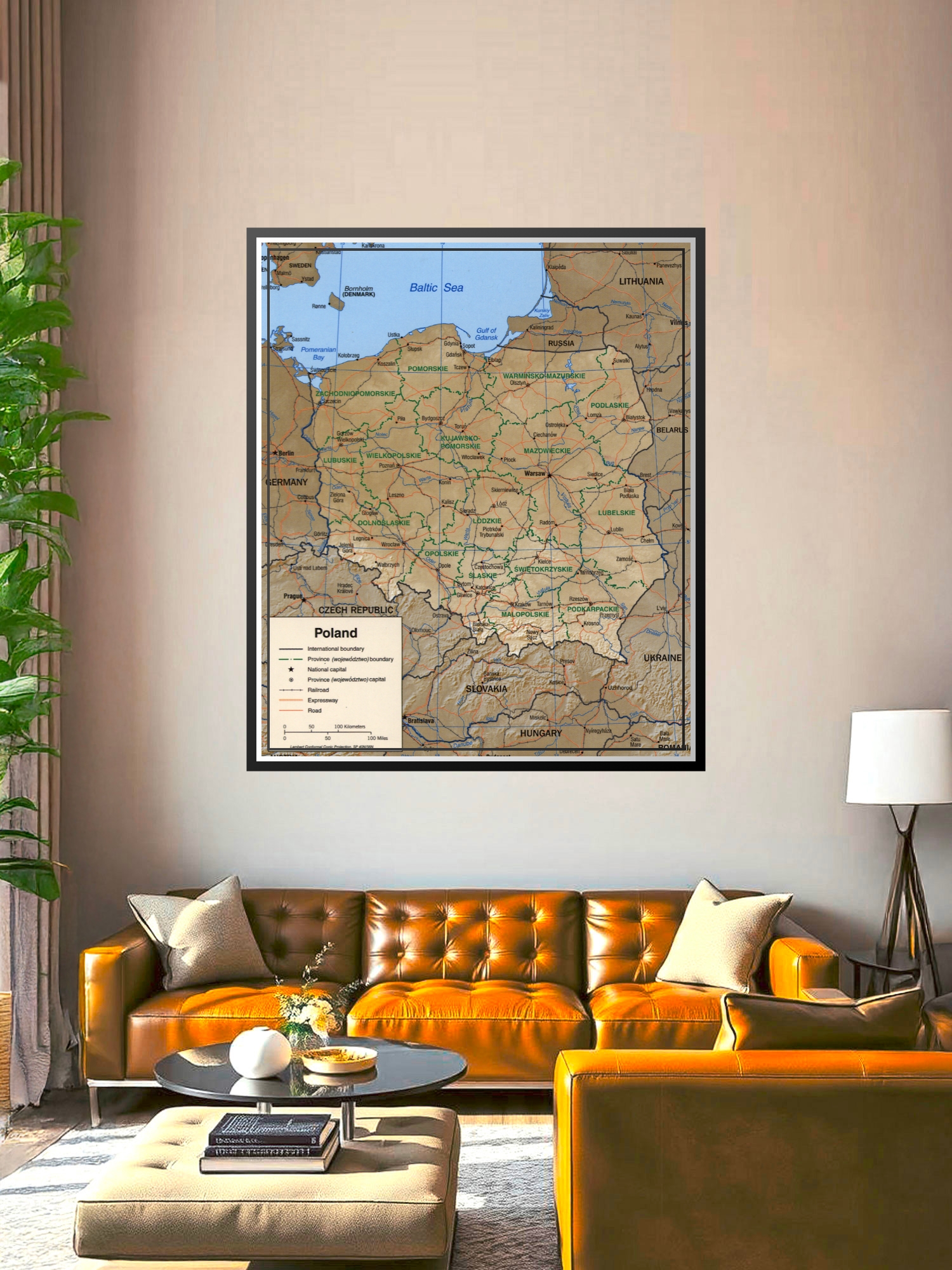
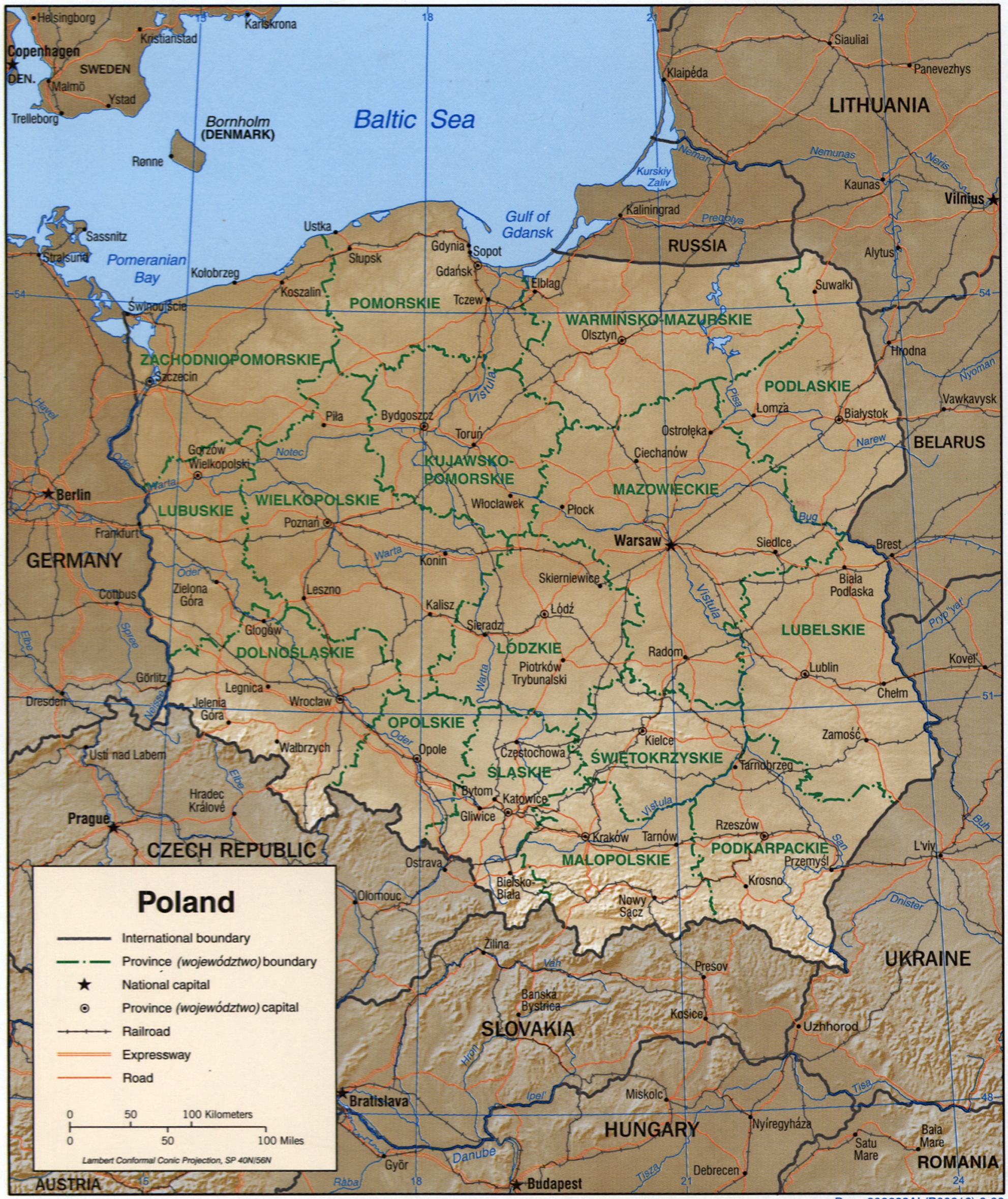
Political Map of Poland Poster – Regional Boundaries & Cities | Educational Wall Art

| Weight | 8 oz |
|---|---|
| Dimensions | 26 × 2 × 2 in |
| Size (inches) | |
| Finishing Options |
Political Map of Poland Poster – Regional Boundaries & Cities | Educational Wall Art
This detailed political map of Poland showcases the country’s 16 provinces (województwo) with clearly marked international borders, provincial boundaries, major cities, and key transportation networks. The map features a warm tan and blue color scheme with green provincial divisions, making it easy to identify each region from Pomerania in the north to Podkarpackie in the southeast. Perfect for classrooms, offices, travel planning, or anyone with Polish heritage seeking an educational and decorative piece. Ideal for students, teachers, geography enthusiasts, and professionals. Printed on archival-grade paper with crisp, fade-resistant inks, ready to frame and display.
Available Finishes
- Sealed with a protective laminate layer for added strength and wipe-clean protection.
- Resists moisture, fingerprints, and scuffs.
- Great for high-traffic areas, classrooms, shops, and break rooms.
- Professional matte-coated paper with a smooth, refined texture.
- Reduces glare while maintaining rich, accurate color tones.
- Perfect for text-heavy designs, illustrations, and minimalist art.
How to Choose the Right Finish for Your Map
Reviews
There are no reviews yet.