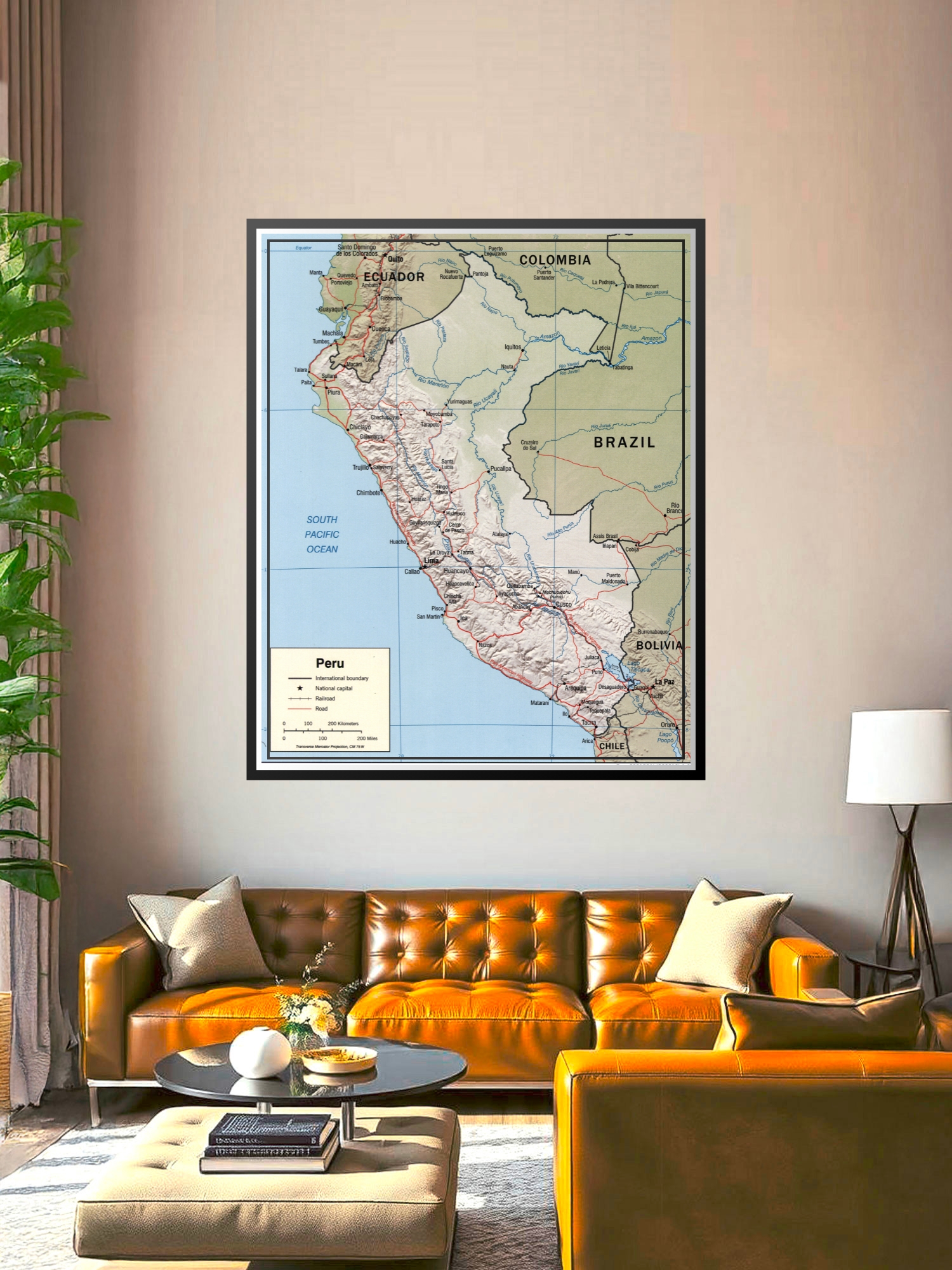
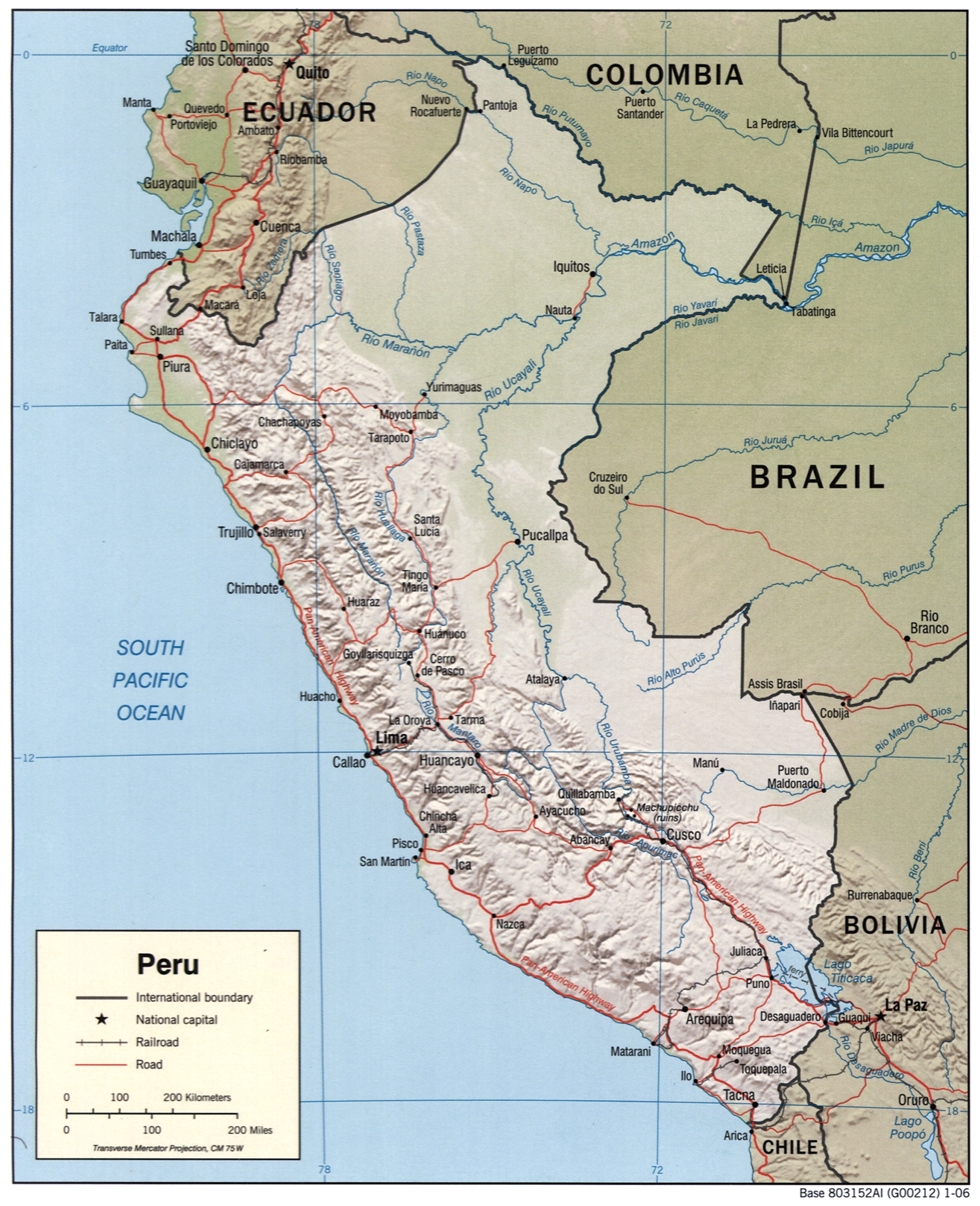
Political Map of Peru Poster – Geographic Reference Wall Art | Educational

| Weight | 8 oz |
|---|---|
| Dimensions | 26 × 2 × 2 in |
| Size (inches) | |
| Finishing Options |
Political Map of Peru Poster – Geographic Reference Wall Art | Educational
Explore the rich geography and borders of Peru with this detailed political map poster. This cartographic print showcases Peru’s international boundaries with Ecuador, Colombia, Brazil, Bolivia, and Chile, along with major cities, rivers, and the dramatic Andes Mountain range. The map features clear topographic shading that reveals the country’s varied terrain, from coastal regions along the South Pacific Ocean to the Amazon Basin in the east. Ideal for classrooms, home offices, travel enthusiasts’ walls, and study spaces, this map combines educational value with timeless design. Perfect as a thoughtful gift for geography teachers, travelers, students, or anyone passionate about South American culture and exploration. Printed on archival-grade paper with crisp, fade-resistant inks, ready to frame and display.
Available Finishes
- Sealed with a protective laminate layer for added strength and wipe-clean protection.
- Resists moisture, fingerprints, and scuffs.
- Great for high-traffic areas, classrooms, shops, and break rooms.
- Professional matte-coated paper with a smooth, refined texture.
- Reduces glare while maintaining rich, accurate color tones.
- Perfect for text-heavy designs, illustrations, and minimalist art.
How to Choose the Right Finish for Your Map


Reviews
There are no reviews yet.