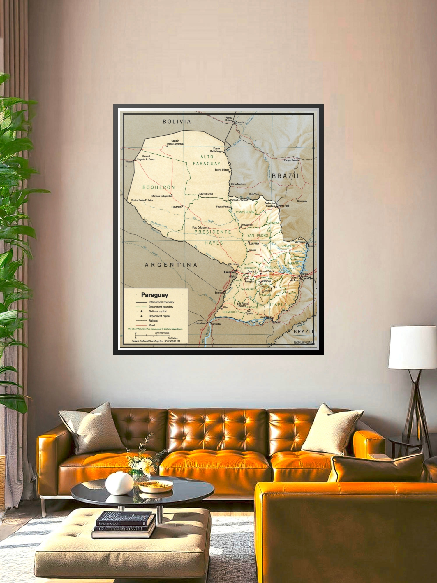
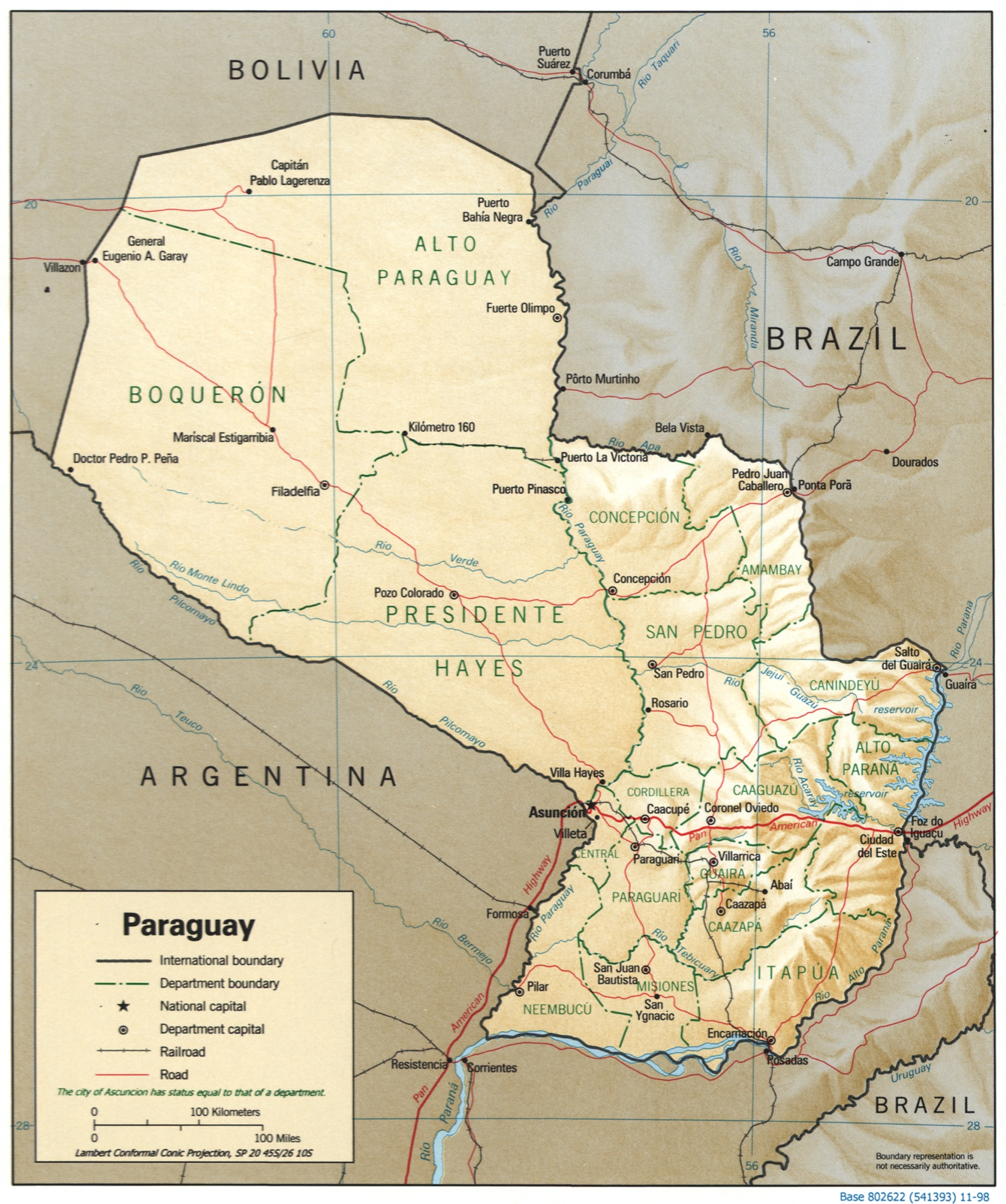
Political Map of Paraguay Poster – Geographic Reference Wall Art | Gift Ideas

| Weight | 8 oz |
|---|---|
| Dimensions | 26 × 2 × 2 in |
| Size (inches) | |
| Finishing Options |
Political Map of Paraguay Poster – Geographic Reference Wall Art | Gift Ideas
Explore the geography and political divisions of Paraguay with this detailed cartographic poster. This educational map displays international boundaries, department divisions, major cities, rivers, and transportation networks in a classic reference style with warm earth tones and precise geographic detail. Perfect for classrooms, home offices, study rooms, and travel enthusiasts who appreciate geographic literacy and cultural knowledge. Ideal as a thoughtful gift for educators, students, travelers, and geography lovers. Printed on archival-grade paper with sharp, readable text and borders, ready to frame and display.
Available Finishes
- Sealed with a protective laminate layer for added strength and wipe-clean protection.
- Resists moisture, fingerprints, and scuffs.
- Great for high-traffic areas, classrooms, shops, and break rooms.
- Professional matte-coated paper with a smooth, refined texture.
- Reduces glare while maintaining rich, accurate color tones.
- Perfect for text-heavy designs, illustrations, and minimalist art.
How to Choose the Right Finish for Your Map
Reviews
There are no reviews yet.