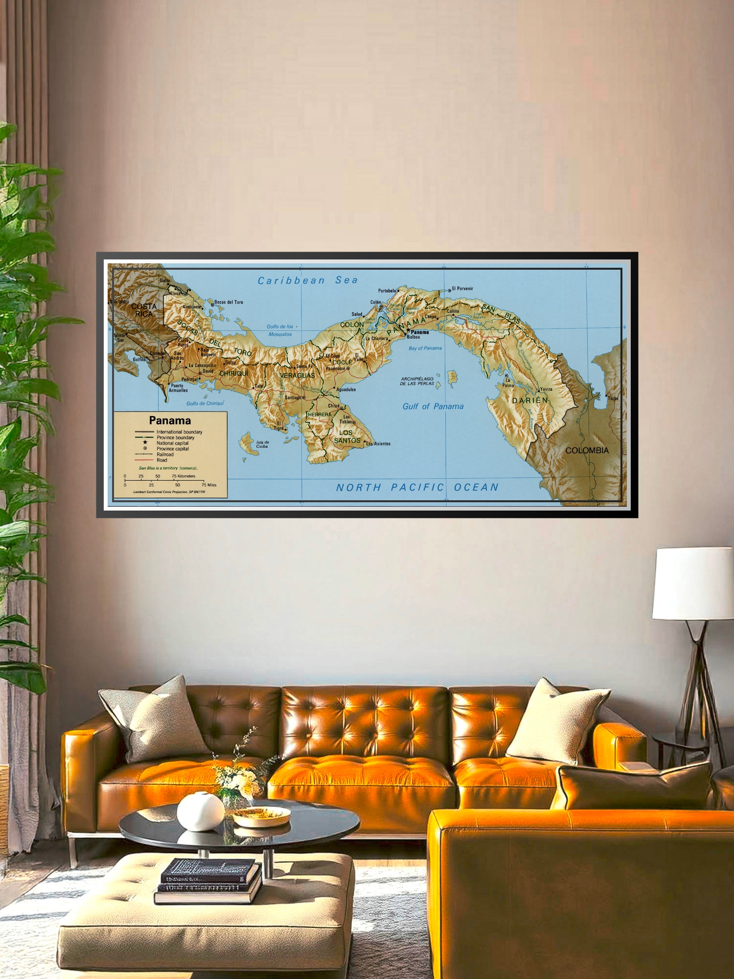
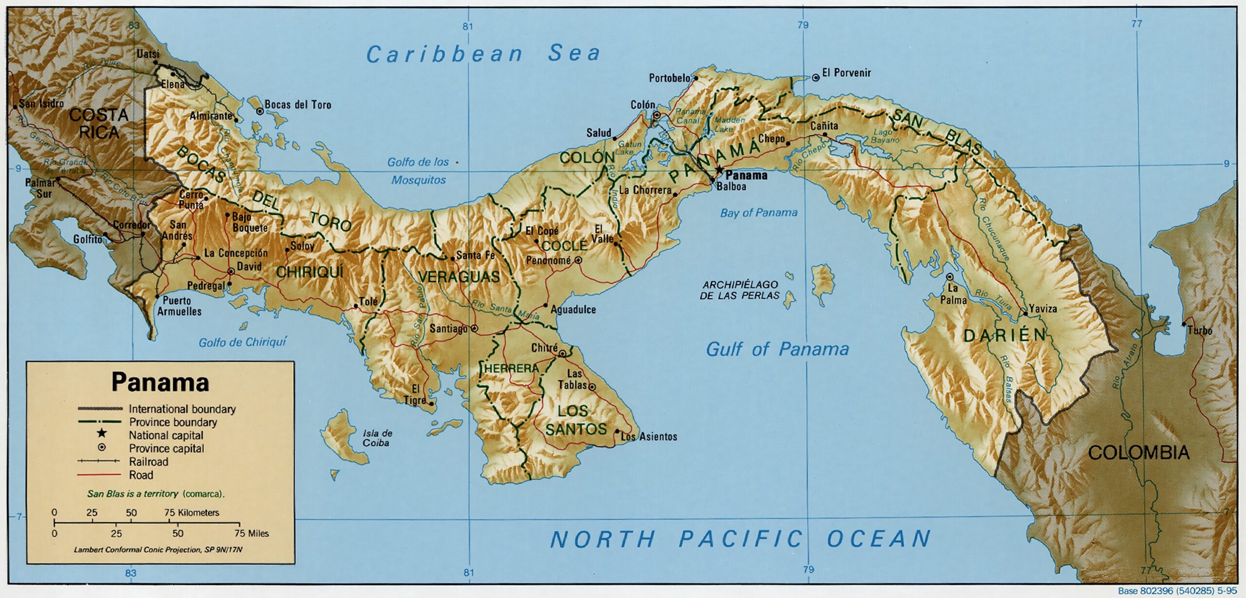
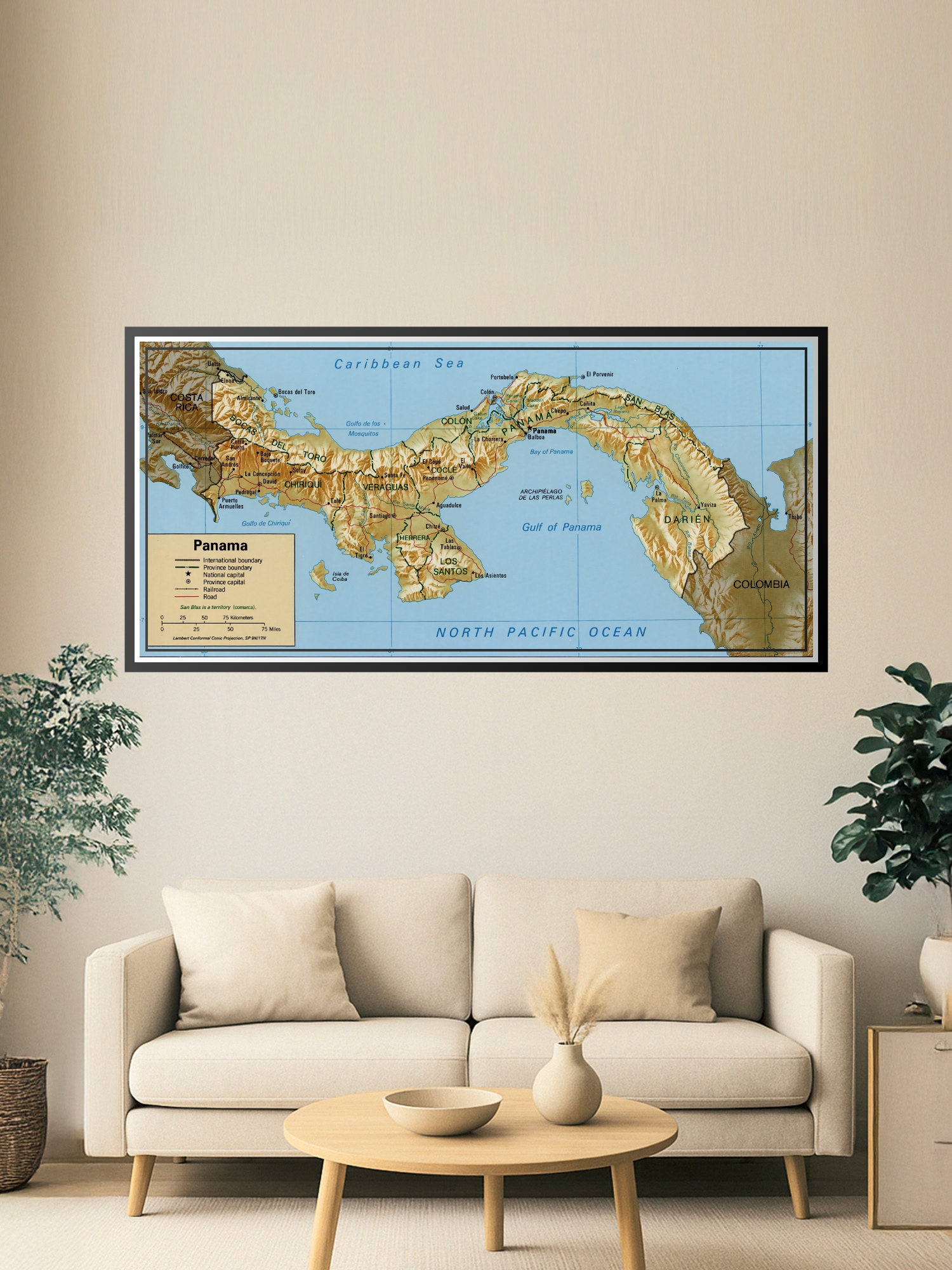
Political Map of Panama – Geographic Reference Wall Art

| Weight | 8 oz |
|---|---|
| Dimensions | 26 × 2 × 2 in |
| Size (inches) | |
| Finishing Options |
Political Map of Panama – Geographic Reference Wall Art
Explore Central America with this detailed political map of Panama, showcasing provinces, major cities, and geographic boundaries with cartographic precision. The map features the Caribbean Sea to the north, the North Pacific Ocean to the south, and neighboring Costa Rica and Colombia, making it an essential reference for geography enthusiasts, travelers, and educators. The classic color palette of tan, blue, and brown creates a timeless aesthetic that complements any study, office, or classroom setting. Ideal for students, travel planners, or anyone passionate about Central American geography, this map serves as both a functional reference tool and an attractive wall display.
Available Finishes
- Sealed with a protective laminate layer for added strength and wipe-clean protection.
- Resists moisture, fingerprints, and scuffs.
- Great for high-traffic areas, classrooms, shops, and break rooms.
- Professional matte-coated paper with a smooth, refined texture.
- Reduces glare while maintaining rich, accurate color tones.
- Perfect for text-heavy designs, illustrations, and minimalist art.
How to Choose the Right Finish for Your Map
similar maps

Reviews
There are no reviews yet.