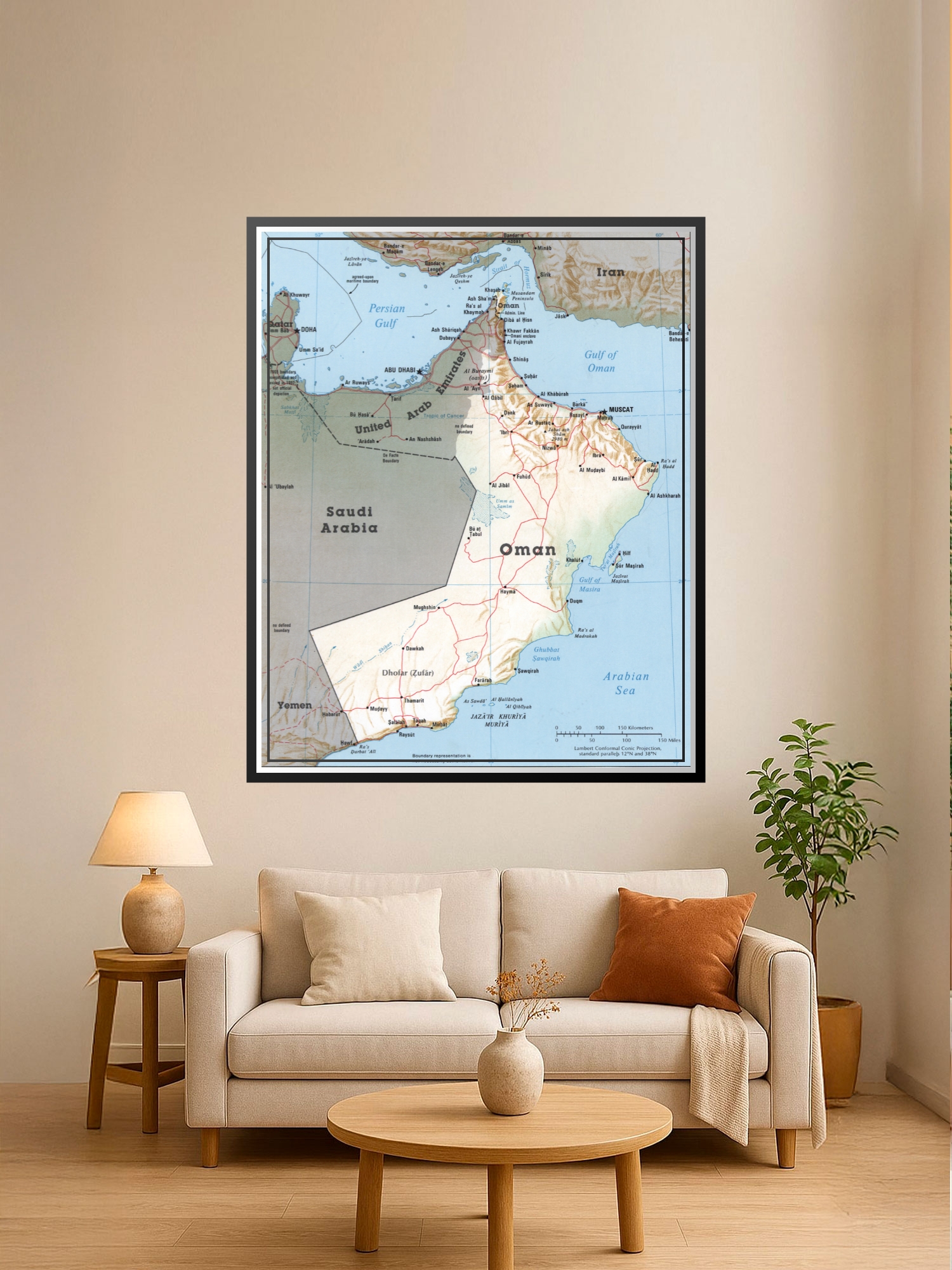
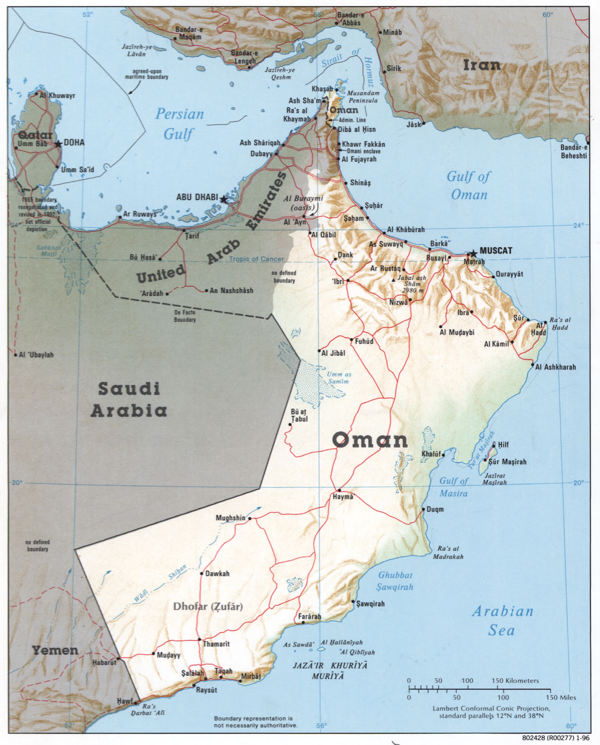
Political Map of Oman Poster – Gulf Region Geography

| Weight | 8 oz |
|---|---|
| Dimensions | 26 × 2 × 2 in |
| Size (inches) | |
| Finishing Options |
Political Map of Oman Poster – Gulf Region Geography
This detailed political map captures the geography and territorial divisions of Oman and its neighboring regions, including the United Arab Emirates, Saudi Arabia, Iran, and Yemen. The cartographic rendering uses distinct color blocks to delineate borders, with topographic shading in the mountainous areas of northern Oman and the Arabian Peninsula, making geographic features immediately legible. Red boundary lines trace major administrative divisions and transportation routes, while blue waterways highlight the Persian Gulf, Gulf of Oman, Arabian Sea, and surrounding maritime boundaries. Ideal for offices, classrooms, home study areas, and travel enthusiasts who appreciate geographic reference art. A thoughtful gift for educators, geographers, travel planners, or anyone with a connection to the Middle East region. Printed on archival-grade paper with vibrant, fade-resistant inks, ready to frame and display.
Available Finishes
- A classic, high-quality poster print with crisp detail and solid color.
- Ideal for everyday wall art, dorms, offices, and framing behind glass.
- Great choice when you want a traditional poster look at a good value.
- Sealed with a protective laminate layer for added strength and wipe-clean protection.
- Resists moisture, fingerprints, and scuffs.
- Great for high-traffic areas, classrooms, shops, and break rooms.
- Professional matte-coated paper with a smooth, refined texture.
- Reduces glare while maintaining rich, accurate color tones.
- Perfect for text-heavy designs, illustrations, and minimalist art.
How to Choose the Right Finish for Your Map

Reviews
There are no reviews yet.