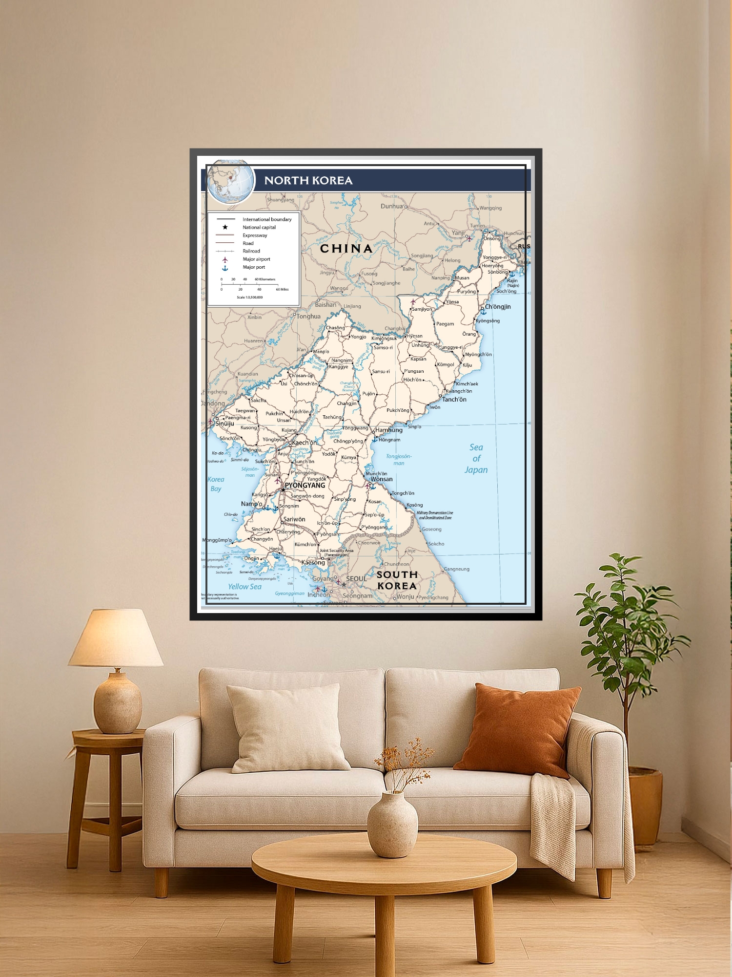
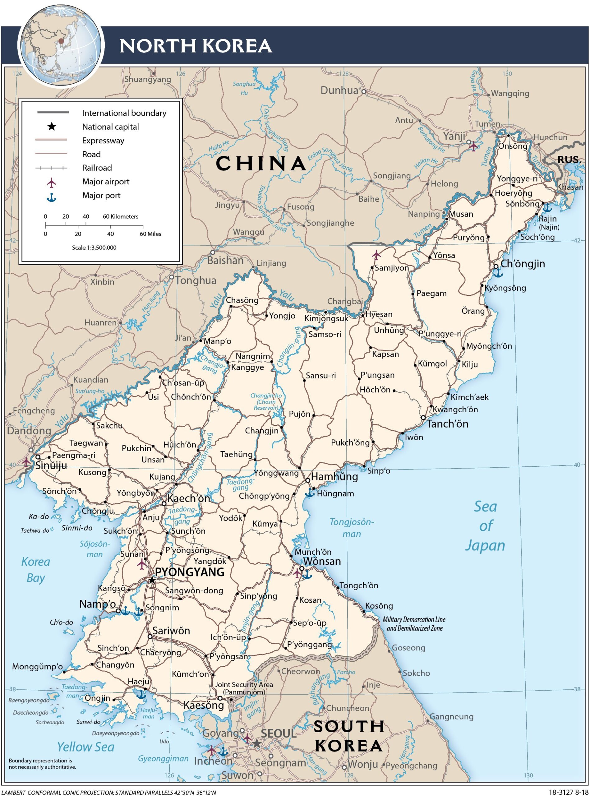
Political Map of North Korea Poster – Geographic Detail

| Weight | 8 oz |
|---|---|
| Dimensions | 26 × 2 × 2 in |
| Size (inches) | |
| Finishing Options |
Political Map of North Korea Poster – Geographic Detail
Explore the geography of North Korea with this detailed political map poster, featuring international boundaries, major cities, transportation networks, and regional landmarks. The map uses a classic cartographic style with a cream and blue color scheme, making it both informative and visually balanced for any space. Perfect for educators, geography enthusiasts, travel planners, and students studying East Asian geopolitics. This professionally printed map on archival-grade paper is ready to frame and display in classrooms, offices, libraries, or home study areas. A thoughtful gift for history buffs, world travelers, or anyone fascinated by global geography.
Available Finishes
- A classic, high-quality poster print with crisp detail and solid color.
- Ideal for everyday wall art, dorms, offices, and framing behind glass.
- Great choice when you want a traditional poster look at a good value.
- Sealed with a protective laminate layer for added strength and wipe-clean protection.
- Resists moisture, fingerprints, and scuffs.
- Great for high-traffic areas, classrooms, shops, and break rooms.
- Professional matte-coated paper with a smooth, refined texture.
- Reduces glare while maintaining rich, accurate color tones.
- Perfect for text-heavy designs, illustrations, and minimalist art.
How to Choose the Right Finish for Your Map
Reviews
There are no reviews yet.