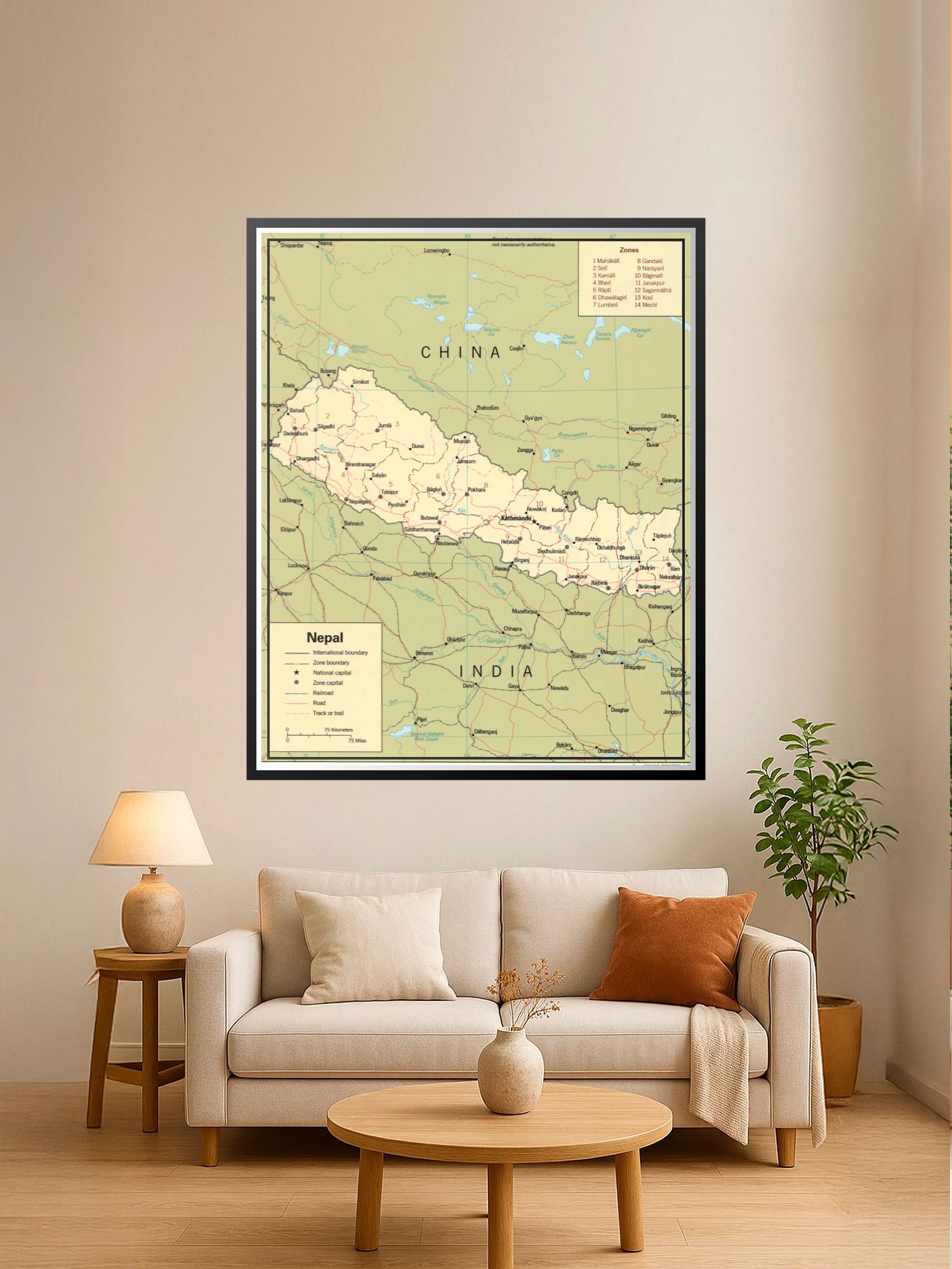
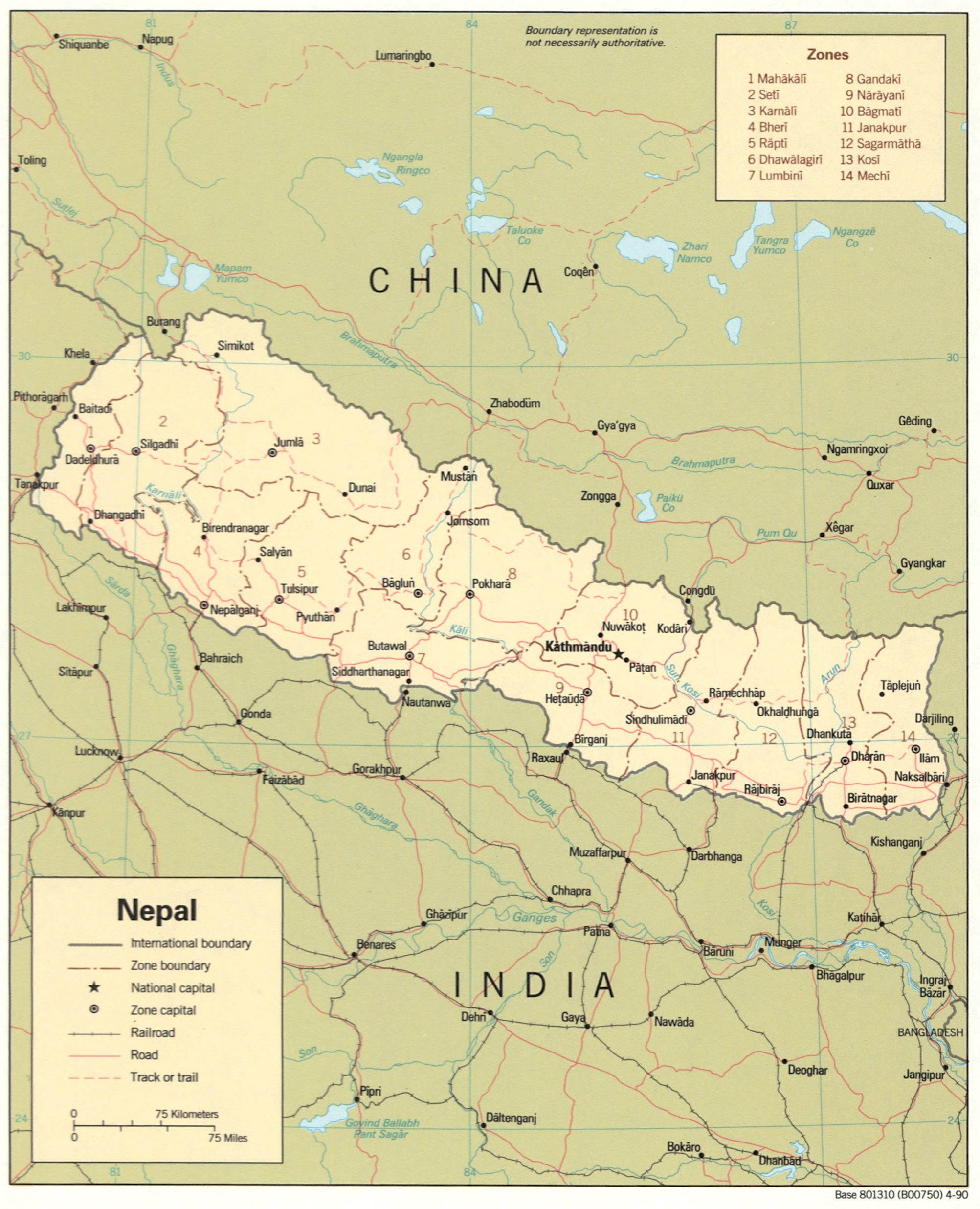
Political Map of Nepal Poster – Educational Geographic Wall Art

| Weight | 8 oz |
|---|---|
| Dimensions | 26 × 2 × 2 in |
| Size (inches) | |
| Finishing Options |
Political Map of Nepal Poster – Educational Geographic Wall Art
Explore the administrative divisions and geographic boundaries of Nepal with this detailed political map poster. Featuring all 14 zones with clearly marked international borders, zone boundaries, major cities, and transportation networks including railroads and roads, this map combines educational value with decorative appeal. The soft cream and sage color palette creates a sophisticated look that complements home offices, classrooms, study rooms, and travel-themed decor. An ideal gift for geography enthusiasts, students, travelers, and anyone passionate about South Asian culture and topography. Printed on archival-grade paper with fade-resistant inks, ready to frame and display.
Available Finishes
- A classic, high-quality poster print with crisp detail and solid color.
- Ideal for everyday wall art, dorms, offices, and framing behind glass.
- Great choice when you want a traditional poster look at a good value.
- Sealed with a protective laminate layer for added strength and wipe-clean protection.
- Resists moisture, fingerprints, and scuffs.
- Great for high-traffic areas, classrooms, shops, and break rooms.
- Professional matte-coated paper with a smooth, refined texture.
- Reduces glare while maintaining rich, accurate color tones.
- Perfect for text-heavy designs, illustrations, and minimalist art.
How to Choose the Right Finish for Your Map

Reviews
There are no reviews yet.