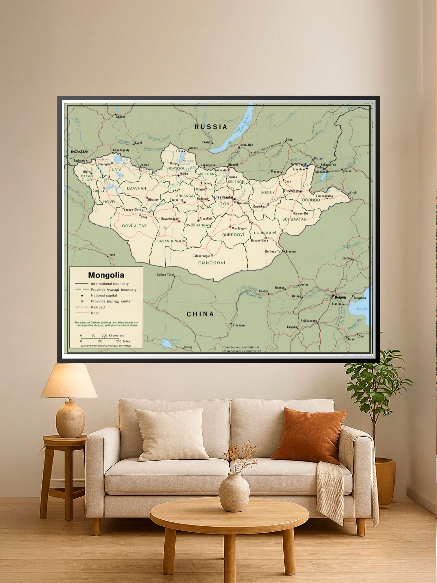
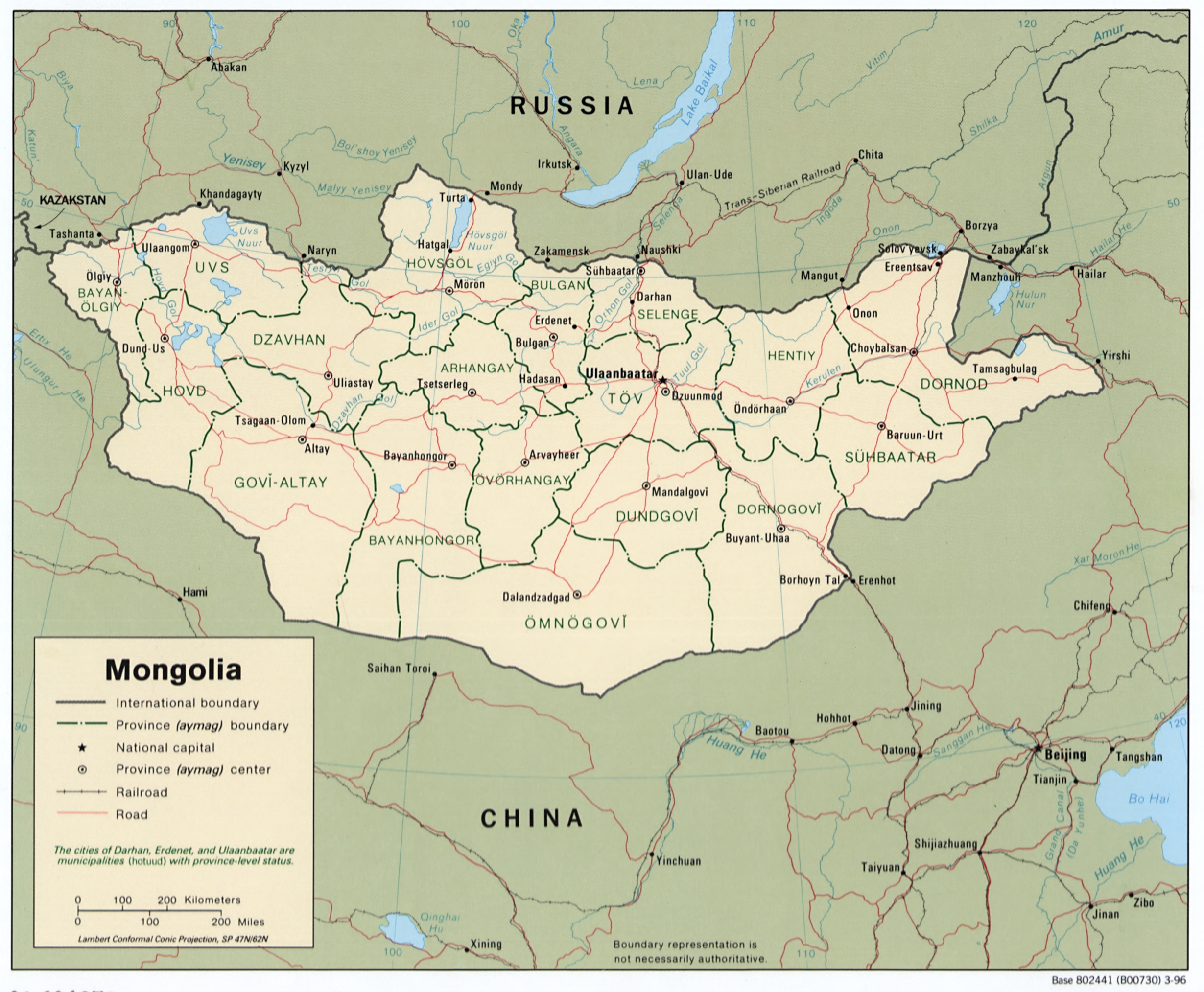
Political Map of Mongolia Poster – Geographic Reference Wall Art

| Weight | 8 oz |
|---|---|
| Dimensions | 26 × 2 × 2 in |
| Size (inches) | |
| Finishing Options |
Political Map of Mongolia Poster – Geographic Reference Wall Art
This detailed political map of Mongolia displays international boundaries, provincial divisions, major cities, and transportation networks with cartographic precision. The map features clearly marked aimags (provinces), the national capital Ulaanbaatar, and neighboring regions of Russia and China, making it an excellent educational and decorative piece. Perfect for classrooms, home offices, travel enthusiasts, and geography lovers who appreciate accurate regional detail. Ideal as a thoughtful gift for students, educators, travelers, or anyone fascinated by Central Asian geography. Printed on archival-grade paper with fade-resistant inks and ready to frame for immediate display.
Available Finishes
- A classic, high-quality poster print with crisp detail and solid color.
- Ideal for everyday wall art, dorms, offices, and framing behind glass.
- Great choice when you want a traditional poster look at a good value.
- Sealed with a protective laminate layer for added strength and wipe-clean protection.
- Resists moisture, fingerprints, and scuffs.
- Great for high-traffic areas, classrooms, shops, and break rooms.
- Professional matte-coated paper with a smooth, refined texture.
- Reduces glare while maintaining rich, accurate color tones.
- Perfect for text-heavy designs, illustrations, and minimalist art.
How to Choose the Right Finish for Your Map
similar maps


Reviews
There are no reviews yet.