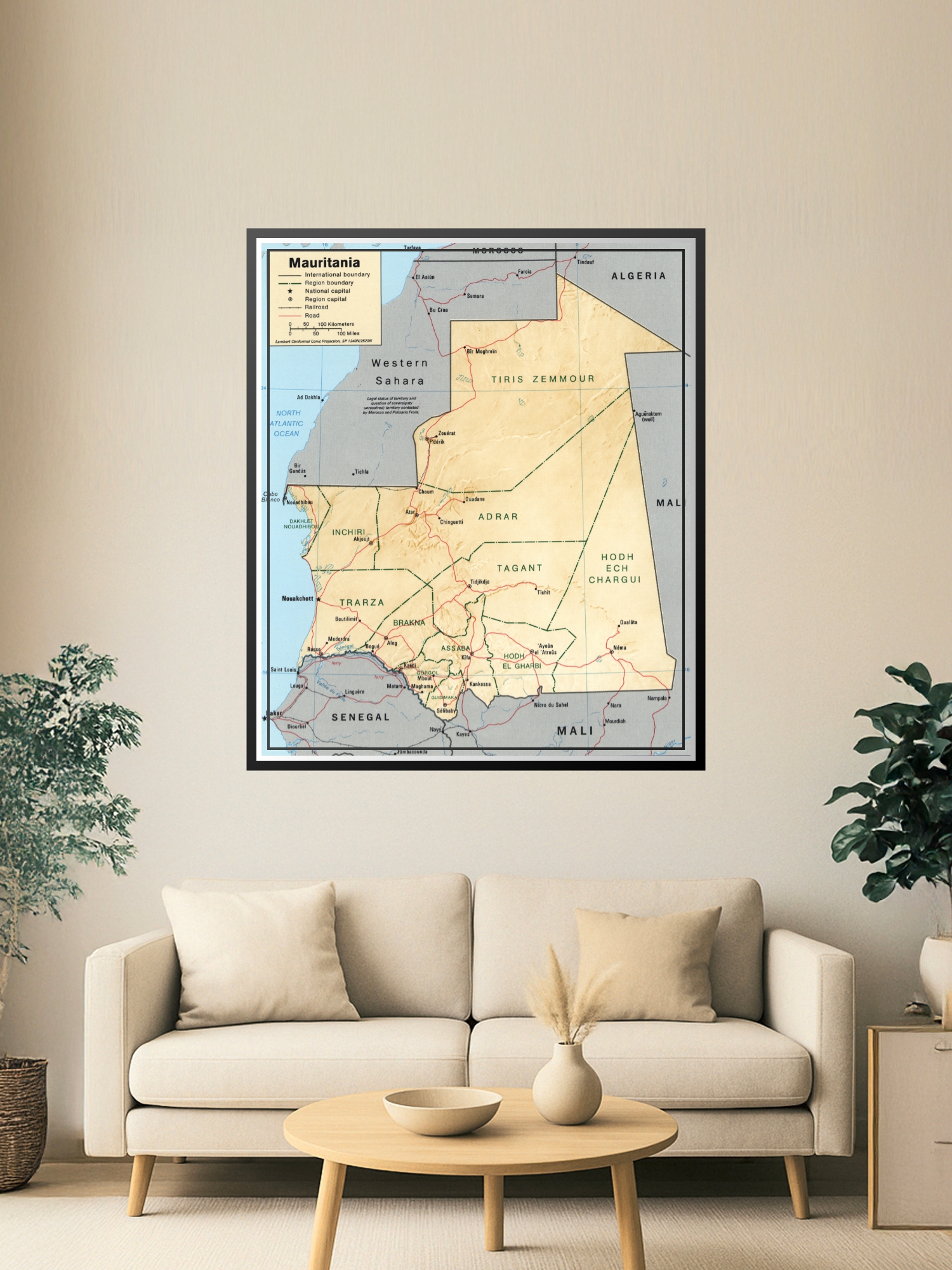
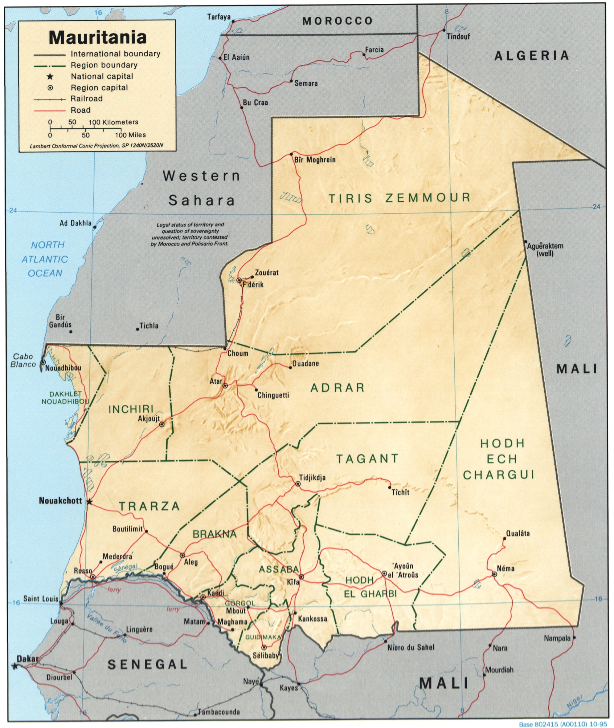
Political Map of Mauritania Poster – Regional Geography & International Borders | Educational Wall Art

| Weight | 8 oz |
|---|---|
| Dimensions | 26 × 2 × 2 in |
| Size (inches) | |
| Finishing Options |
Political Map of Mauritania Poster – Regional Geography & International Borders | Educational Wall Art
This detailed political map of Mauritania showcases the country’s regional divisions, international boundaries, and major cities with precision and clarity. The warm beige and cream tones highlight the desert landscape, while clear boundary lines in red and black delineate regions, national capitals, and neighboring countries including Morocco, Algeria, Mali, and Senegal. Perfect for classrooms, home offices, travel enthusiasts, and geography lovers, this cartographic wall art combines educational value with a clean, classic aesthetic. A thoughtful gift for students, educators, travelers, and anyone fascinated by African geography and regional study. High-quality cartographic print on archival-grade paper, ready to frame and display.
Available Finishes
- A classic, high-quality poster print with crisp detail and solid color.
- Ideal for everyday wall art, dorms, offices, and framing behind glass.
- Great choice when you want a traditional poster look at a good value.
- Sealed with a protective laminate layer for added strength and wipe-clean protection.
- Resists moisture, fingerprints, and scuffs.
- Great for high-traffic areas, classrooms, shops, and break rooms.
How to Choose the Right Finish for Your Map
Reviews
There are no reviews yet.