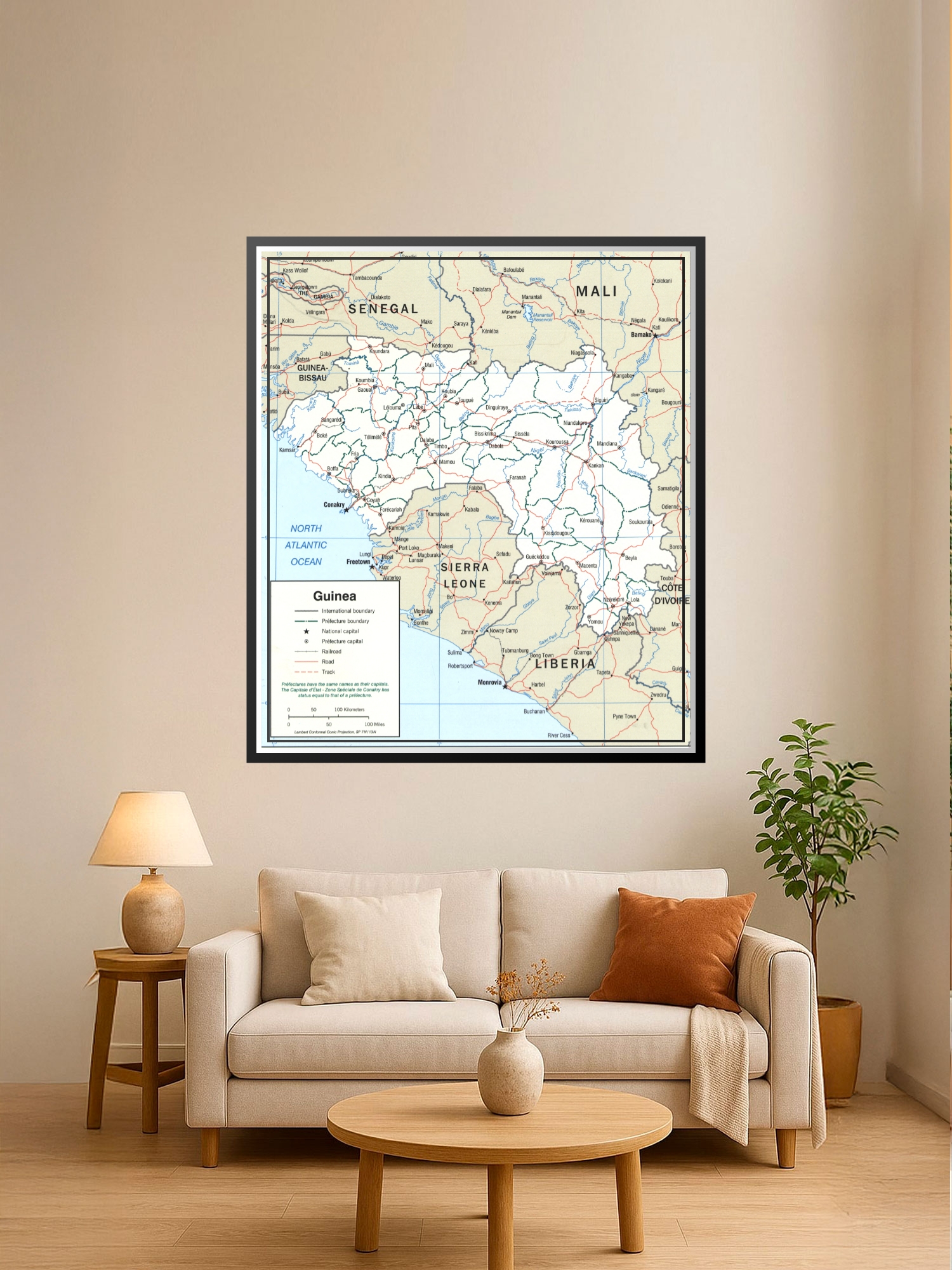
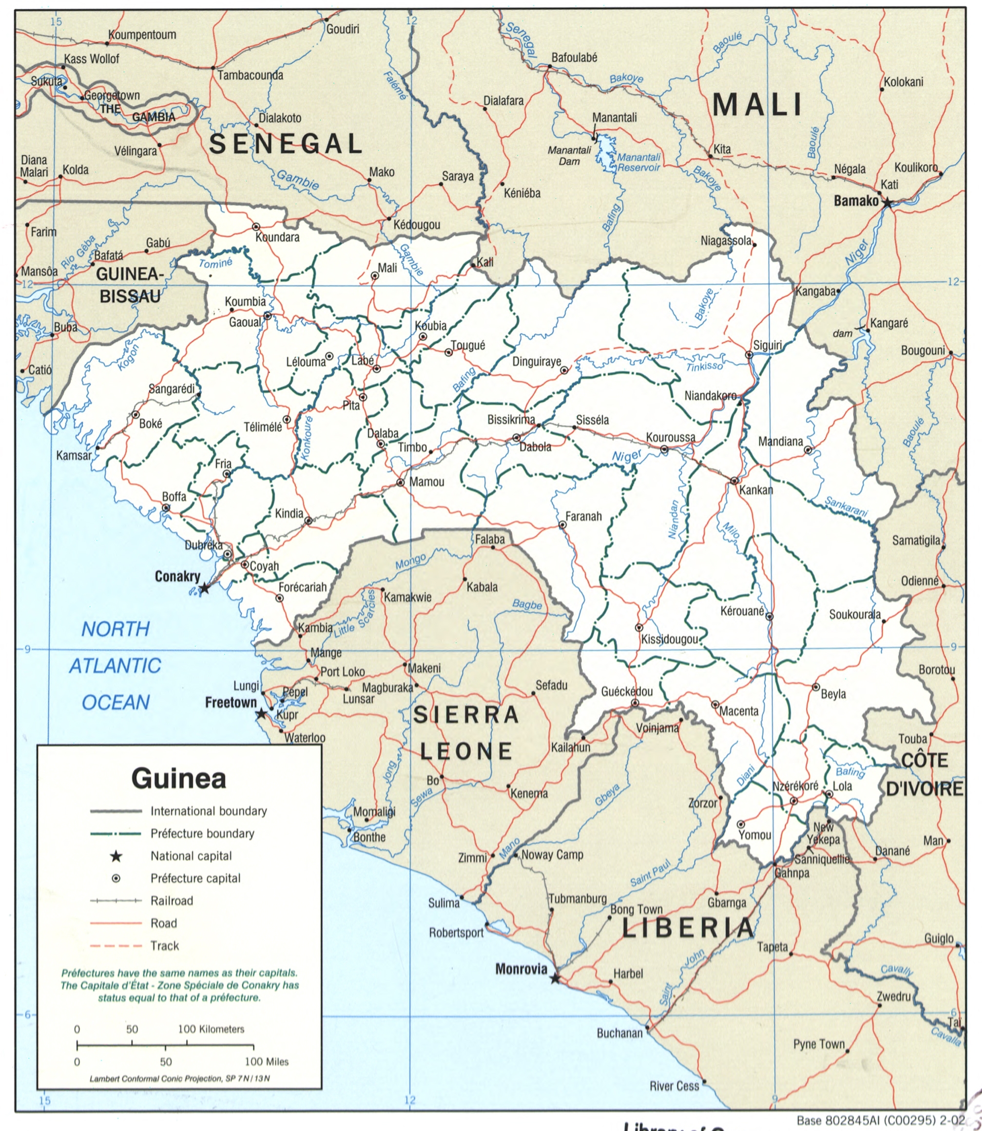
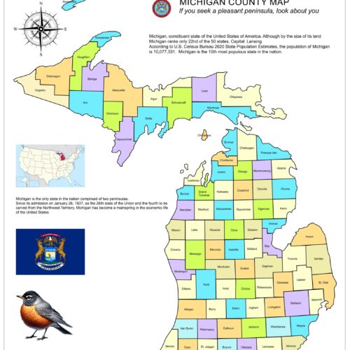
Political Map of Guinea Poster – Regional Borders & Geographic Detail

| Weight | 8 oz |
|---|---|
| Dimensions | 26 × 2 × 2 in |
| Size (inches) | |
| Finishing Options |
Political Map of Guinea Poster – Regional Borders & Geographic Detail
Bring cartographic character to your space with Political Map of Guinea Poster – Regional Borders & Geographic Detail. This political map wall art print presents Political Map of Guinea – Regional Borders & Geographic Detail in a decorative yet useful format, making it suitable for home offices, classrooms, studios, libraries and travel-themed rooms. Its map-focused layout gives the piece both visual interest and educational value. Select the available material and size options to match your display style. Frame not included.
Political Map of Guinea map poster with political map character, ideal for offices, classrooms, libraries, studies and travel-inspired wall decor.
How to Choose the Right Finish for Your Map
Reviews
There are no reviews yet.