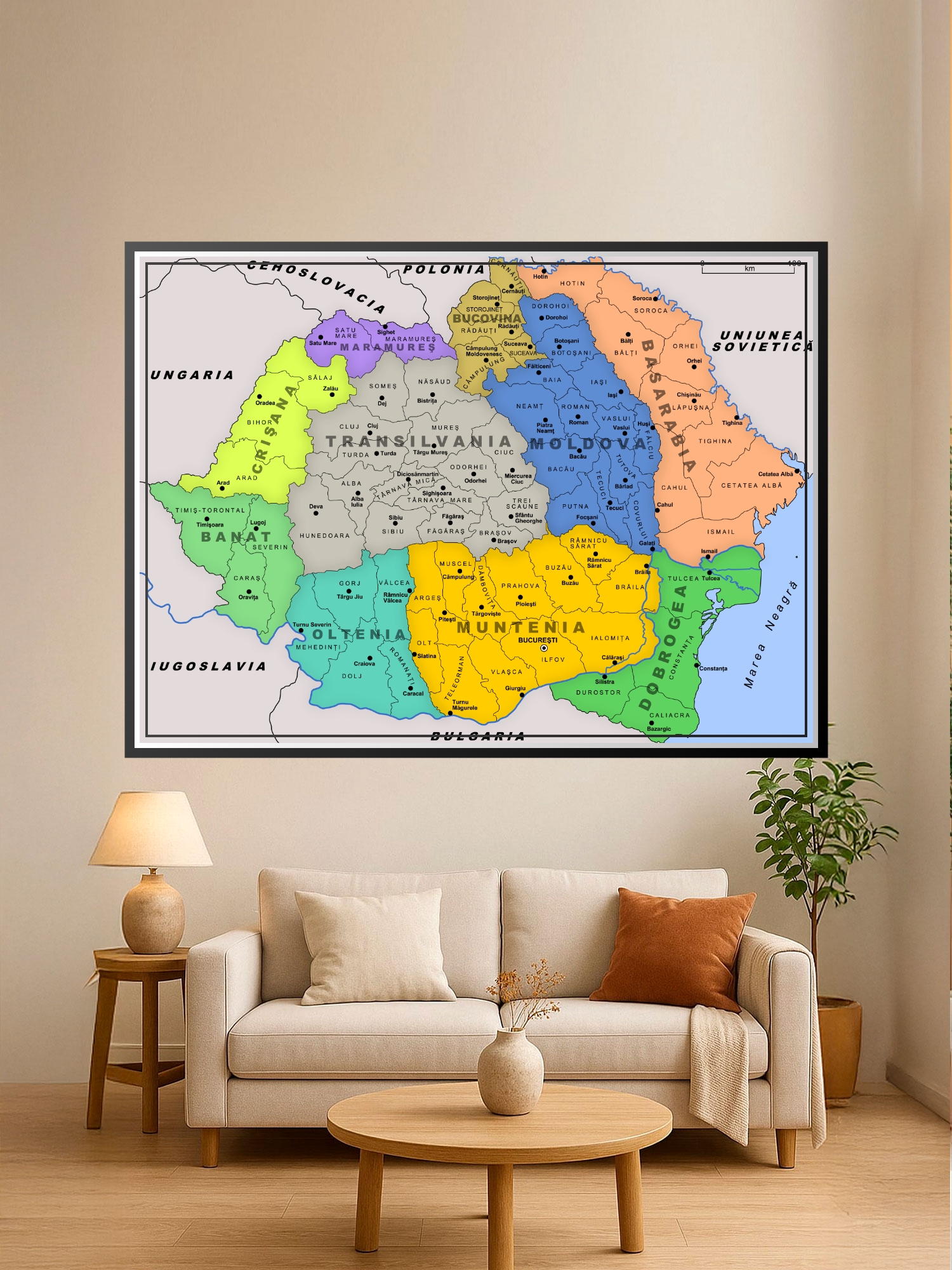
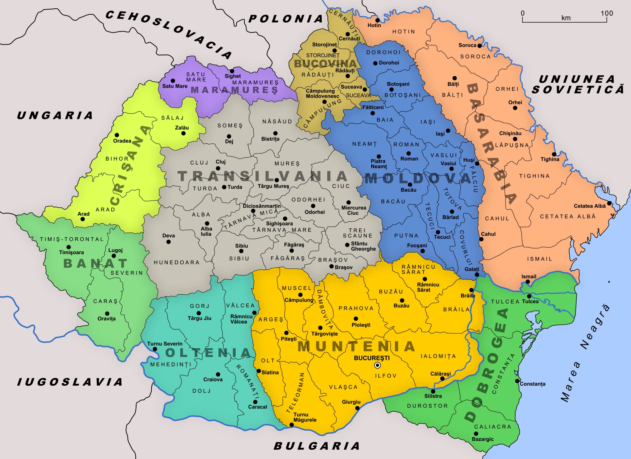
Greater Romania Administrative Map 1930- Regional Geography | Educational

| Weight | 8 oz |
|---|---|
| Dimensions | 26 × 2 × 2 in |
| Size (inches) | |
| Finishing Options |
Greater Romania Administrative Map 1930- Regional Geography | Educational
Step back into the interwar period with this stunning tribute to România Mare (Greater Romania). Capturing the country at its greatest territorial peak following the historic Great Union, this piece beautifully traces the borders that brought Transylvania, Bessarabia, Bukovina, and the Old Kingdom together into a unified nation. Perfect for history enthusiasts, educators, or anyone looking to add a touch of timeless European heritage and sophisticated storytelling to their home, office, or study.
Available Finishes
- A classic, high-quality poster print with crisp detail and solid color.
- Ideal for everyday wall art, dorms, offices, and framing behind glass.
- Great choice when you want a traditional poster look at a good value.
- Sealed with a protective laminate layer for added strength and wipe-clean protection.
- Resists moisture, fingerprints, and scuffs.
- Great for high-traffic areas, classrooms, shops, and break rooms.
- Professional matte-coated paper with a smooth, refined texture.
- Reduces glare while maintaining rich, accurate color tones.
- Perfect for text-heavy designs, illustrations, and minimalist art.
- Museum-quality premium canvas printed with fade-resistant archival inks.
- Shipped rolled in a protective tube with a 1.5-inch white border for easy stretching or framing.
- Professional, gallery-quality presentation ideal for fine art reproductions.
How to Choose the Right Finish for Your Map
similar maps


Reviews
There are no reviews yet.