
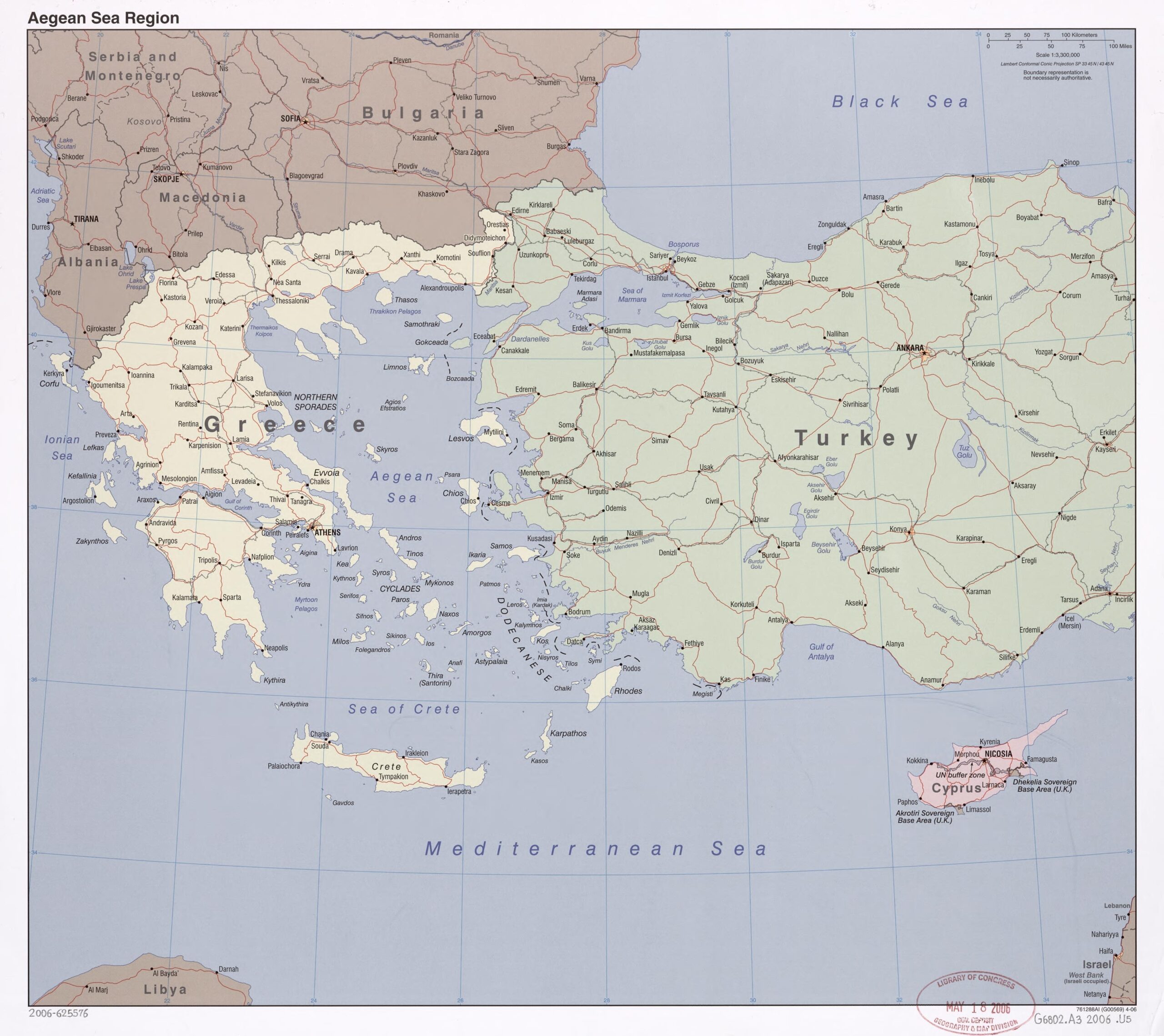

24x27in Poster Aegean Sea Region Map – Greece, Turkey & Cyprus Political Geography (2005)
Explore the historical and geopolitical complexity of the Aegean Sea region with this 2005 map featuring Greece, Turkey, Cyprus, and surrounding waters. It displays detailed road networks, island groupings like the Cyclades and Dodecanese, and major cities including Athens, Ankara, and Nicosia. Ideal for academic reference, travel planning, or wall display.


Reviews
There are no reviews yet.