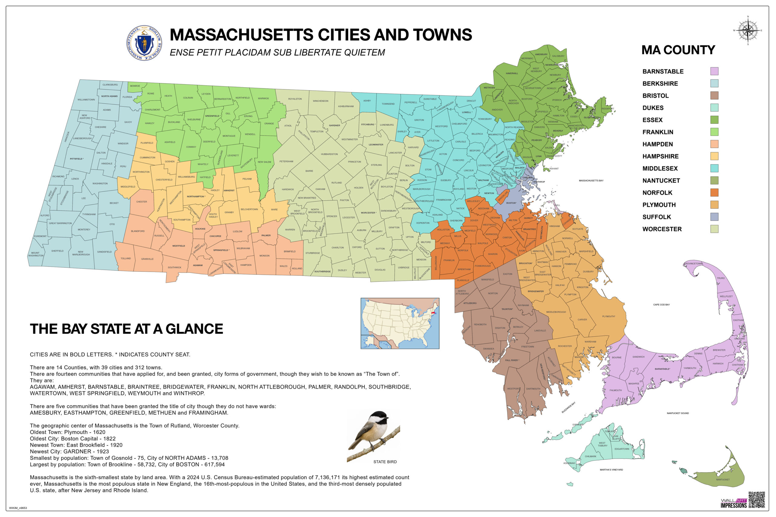
The Best Uses for a Color-Coded Massachusetts County Map for Educational Purposes
If you’re looking to bring geography to life in the classroom or at home, a color-coded Massachusetts county map is one of the most versatile and effective visual tools available. Whether you’re teaching young students the basics of state geography or providing context for U.S. history and civics lessons, this kind of map can enhance comprehension, engagement, and retention. In this article, we’ll explore the best educational uses for a Massachusetts county map with cities and towns, especially one that uses clear color coding to distinguish each county.
1. Teaching State Geography in Elementary and Middle School
For younger students, learning all 14 counties of Massachusetts can feel abstract and challenging. A color-coded Massachusetts wall map makes it easy to differentiate each county visually. Teachers can use the map to:
- Introduce students to the geographical layout of Massachusetts
- Teach county names and locations using visual memory
- Quiz students on cities and towns within each region
- Explain the concept of county borders and government divisions
Color coding helps break down complex geographical data into digestible segments, making it ideal for early education settings.
2. Supporting Special Education and Visual Learners
Color-coded maps are especially helpful for students with special needs or those who are visual learners. A Massachusetts educational map with high-contrast colors and legible fonts can:
Improve comprehension through visual association
Aid memory retention for students with learning disabilities
Offer a calm and structured way to process information
Teachers can customize lessons by focusing on one region at a time or using removable labels and interactive activities.
3. Homeschooling & At-Home Education
Parents who homeschool or support remote learning can benefit from displaying a large Massachusetts map with labeled cities and counties at home. It serves as:
A daily point of reference for geography, history, or civics
A hands-on tool for interactive activities like labeling, pinning locations, or tracing routes
A colorful and educational decor piece that sparks curiosity
5. School Projects, Posters, and Classroom Decor
Students often need to create posters or presentations for school assignments on topics like:
Massachusetts counties and townships
Local government structures
Population distribution by county
Famous historical sites and events
Having a color-coded Massachusetts classroom map makes it easier for students to visualize, cite, and showcase their research.