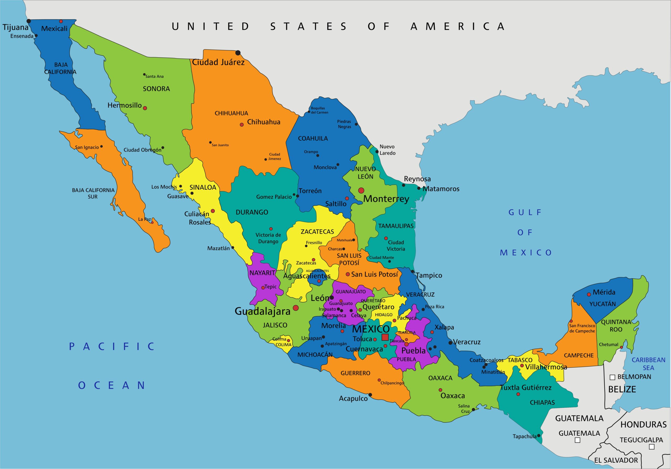
Political Map of Mexico with States and Major Cities Wall Poster [24×34]
Shop the Wall Art Impressions collection of wall maps, including country maps, state maps, political maps, physical maps, thematic maps, and more. This is a detailed political map of Mexico, showcasing its states in various colors for easy differentiation. Major cities, including state capitals and key urban centers, are marked for reference. The map highlights Mexico’s geographical boundaries with the United States, Guatemala, and Belize, as well as its surrounding bodies of water, including the Pacific Ocean and the Gulf of Mexico. This map serves as a useful tool for geographical study, travel planning, or general reference.
Reviews
There are no reviews yet.