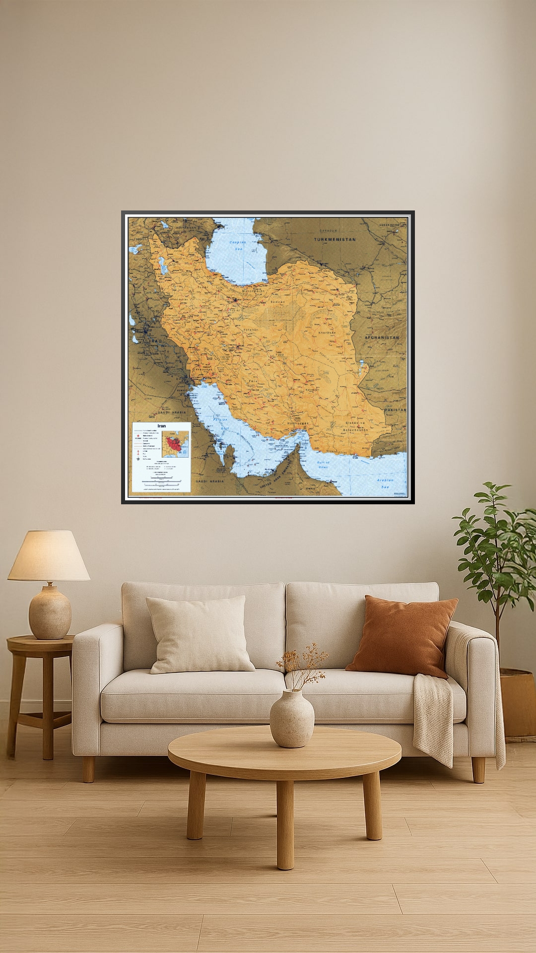
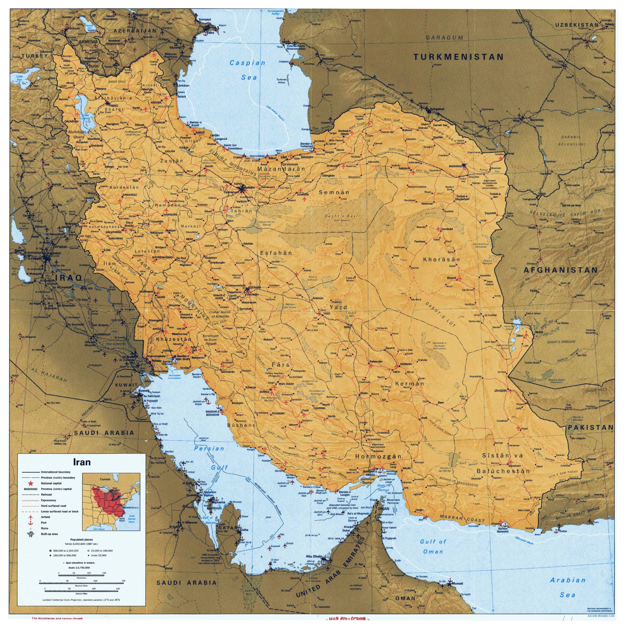
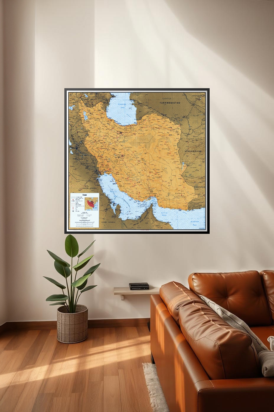
Political Map of Iran – Detailed Geographic Wall Art Print
This detailed political map of Iran highlights the country’s provinces, major cities, and surrounding borders with Iraq, Turkey, Turkmenistan, Afghanistan, and Pakistan. It also includes the Caspian Sea, Persian Gulf, and Gulf of Oman, offering a complete geographical perspective. Perfect for classrooms, offices, or travel enthusiasts who appreciate educational and decorative wall art with historical and regional insight.


Reviews
There are no reviews yet.