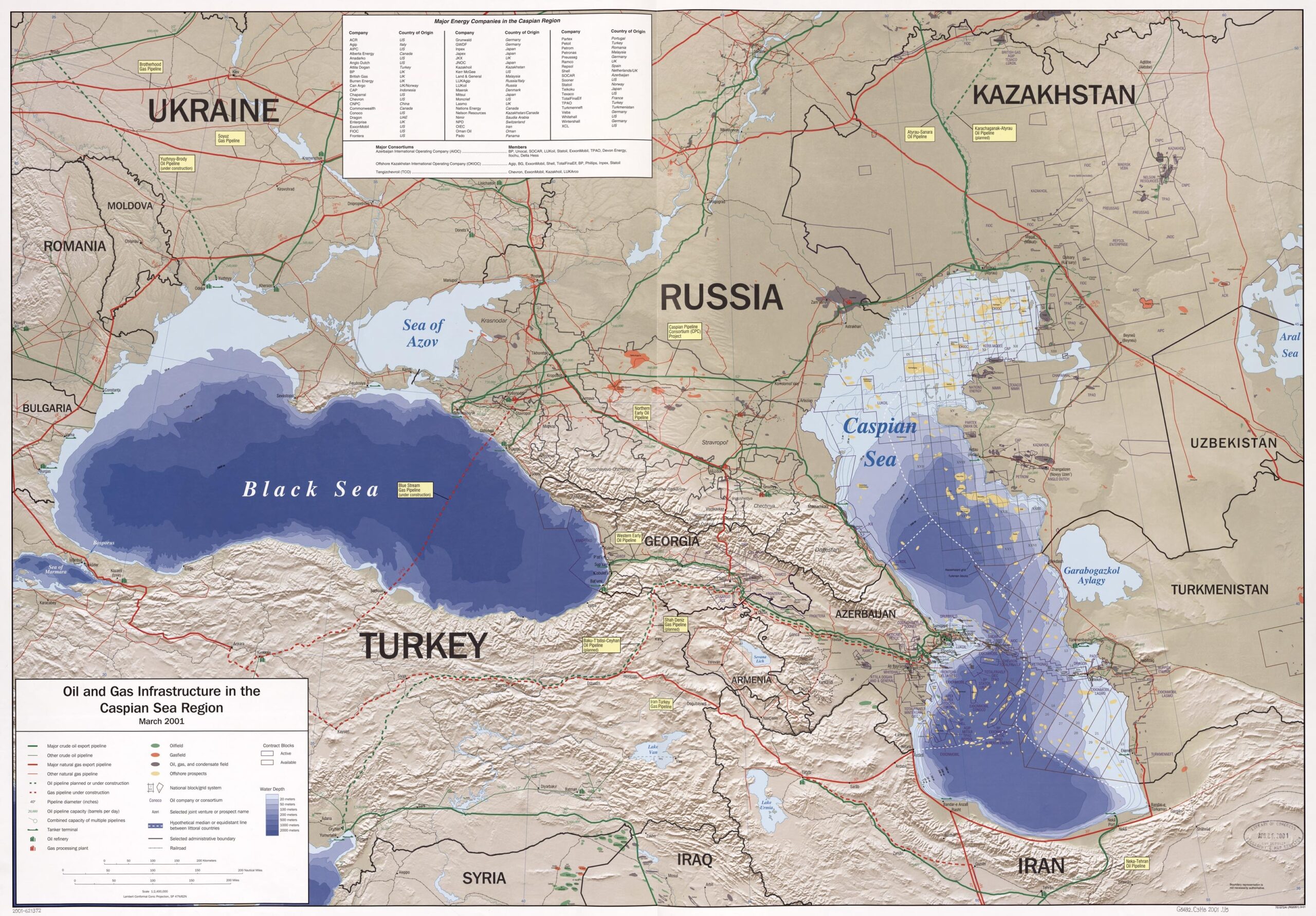
Oil & Gas Infrastructure Map – Caspian and Black Sea Region (2001)


| Weight | 8 oz |
|---|---|
| Dimensions | 26 × 2 × 2 in |
| Size (inches) | |
| Finishing Options |
Oil & Gas Infrastructure Map – Caspian and Black Sea Region (2001)
Detailed 2001 map showing oil and gas infrastructure across the Caspian and Black Sea regions, highlighting pipelines, tanker routes, exploration blocks, refineries, and major energy companies. Covers key countries such as Russia, Kazakhstan, Azerbaijan, Georgia, Turkey, Ukraine, Iran, and more. A valuable resource for energy analysts, historians, and geopolitical researchers.
How to Choose the Right Finish for Your Map

Reviews
There are no reviews yet.