
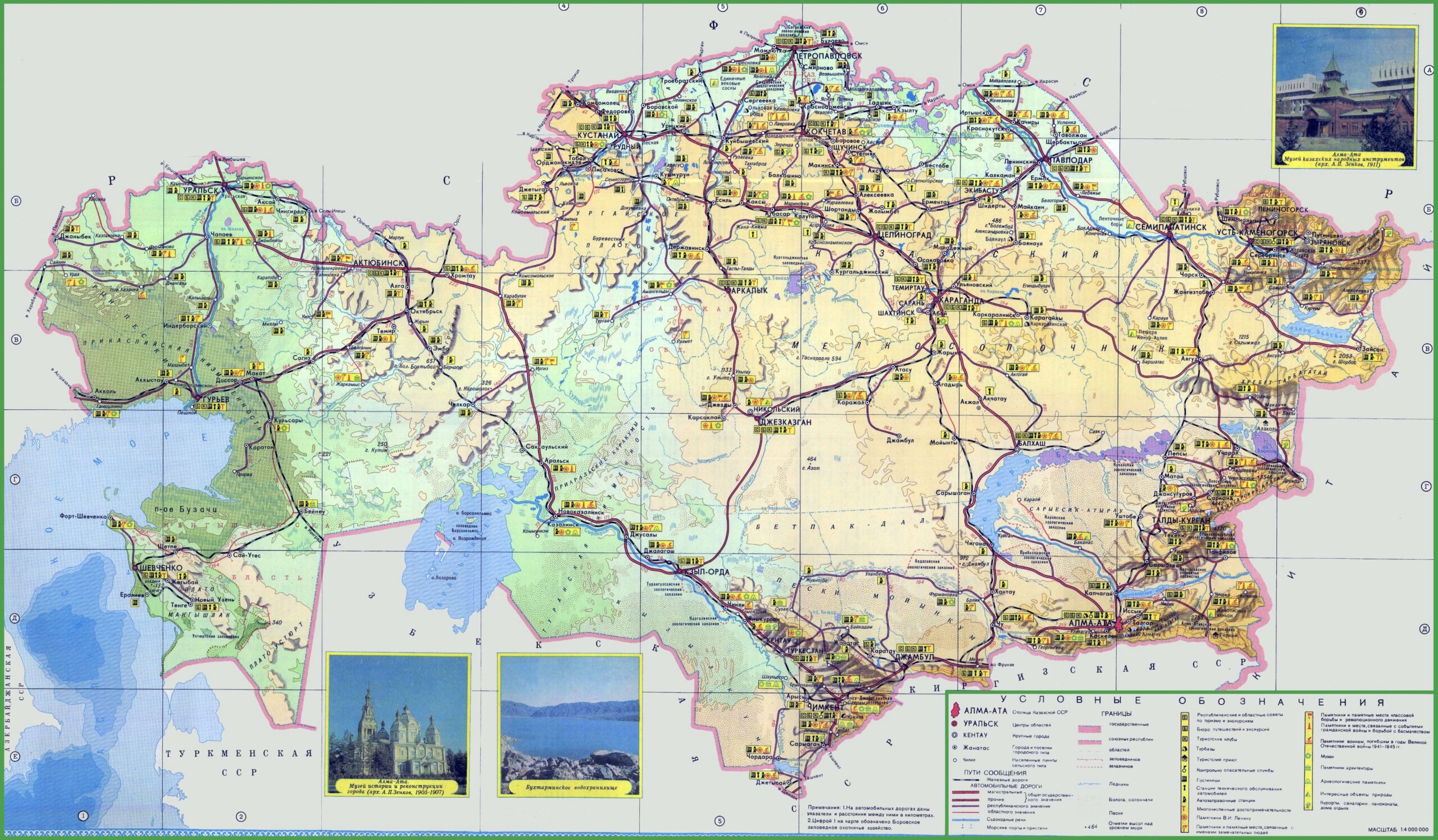

Kazakhstan Political Map Poster (RU)– Soviet-Era Regional and Transport Wall Art
Discover the vast geography of Central Asia with this Soviet-era Kazakhstan Political Map Poster. Featuring detailed oblast borders, major cities, railway and road networks, and topographic relief, this historical map includes Alma-Ata, Karaganda, and the Caspian Sea coastline. A great piece for educators, collectors, and history lovers seeking unique cartographic wall decor.


Reviews
There are no reviews yet.