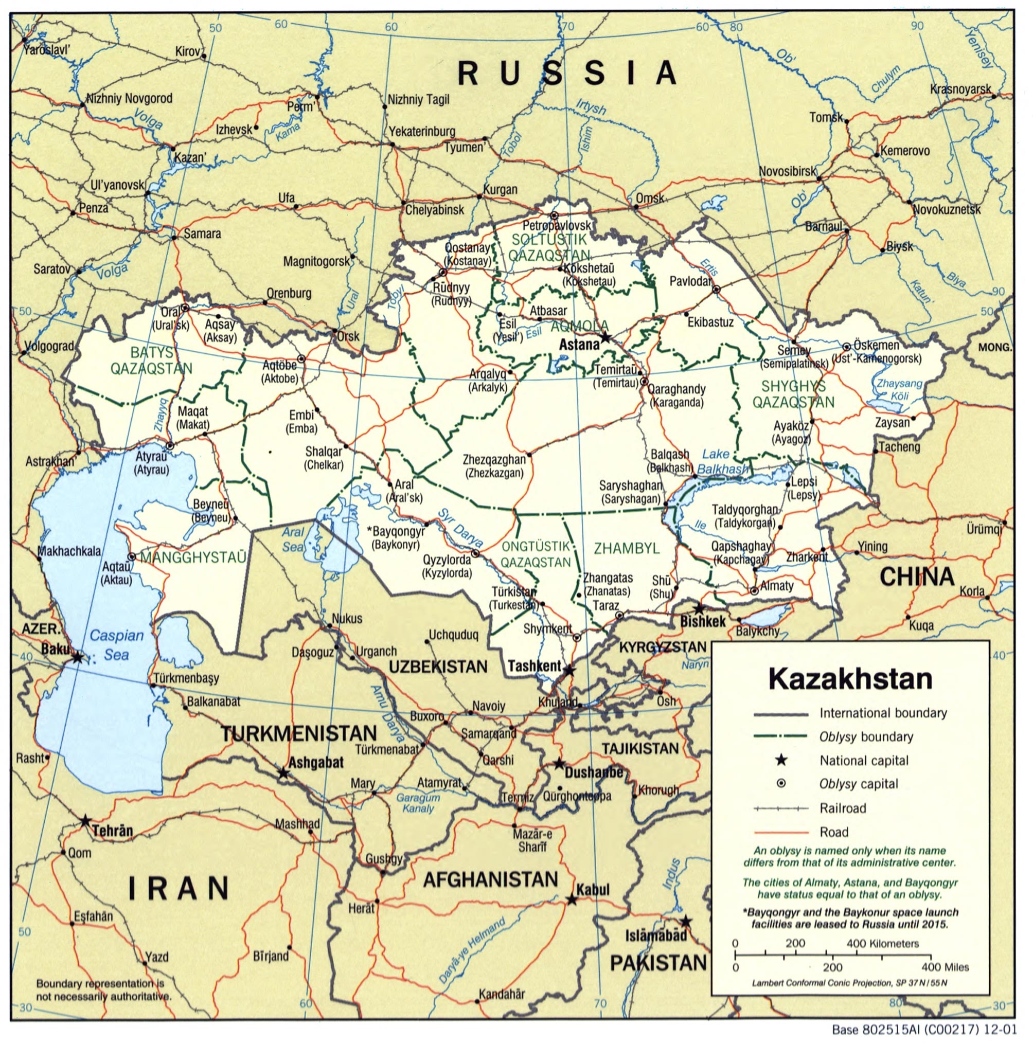

Kazakhstan Administrative Map – Political Boundaries and Key Cities
This detailed political map of Kazakhstan highlights international boundaries, oblast (regional) divisions, major cities, railroads, and roads. Key cities such as Astana, Almaty, and Baikonur are clearly labeled, along with neighboring countries including Russia, China, and Uzbekistan. Ideal for educational, strategic, or geographic reference use.


Reviews
There are no reviews yet.