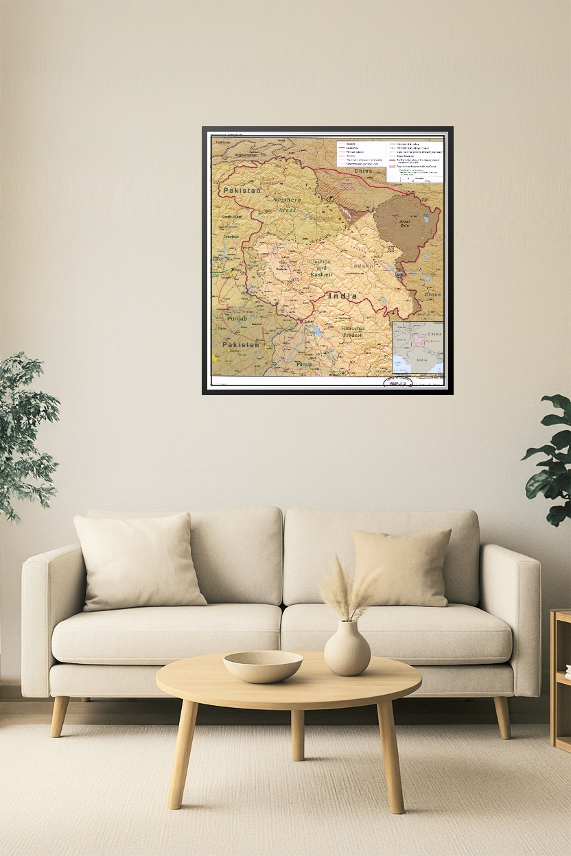
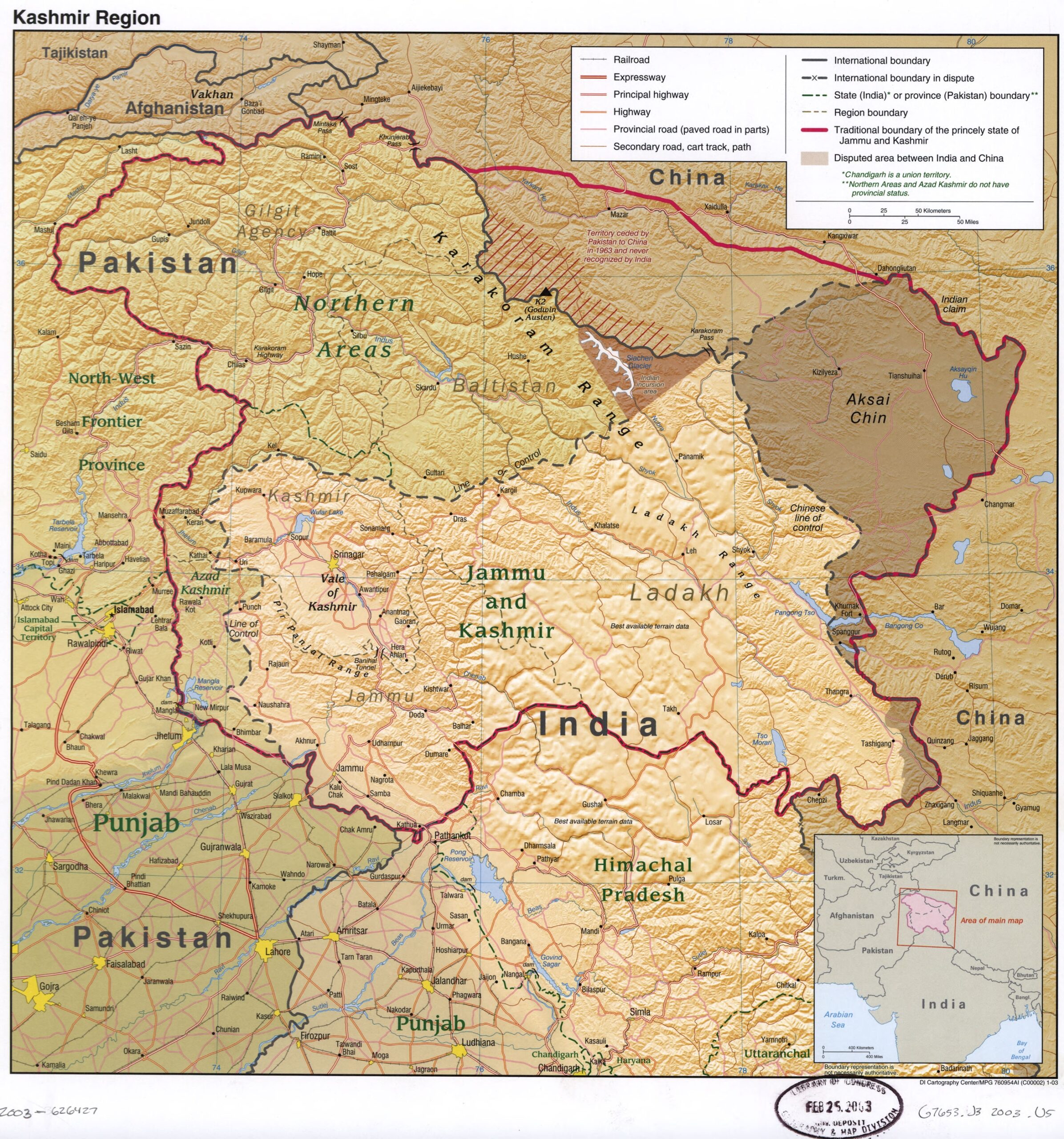

Kashmir Region Map Poster – Political Boundaries & Disputed Territories
Understand the complex geopolitics and terrain of one of the world’s most contested regions with this detailed Kashmir Region map poster. It displays international borders, disputed territories between India, Pakistan, and China, including Jammu & Kashmir, Ladakh, Azad Kashmir, Gilgit-Baltistan, and Aksai Chin. Featuring roads, railways, rivers, and elevation relief, this map is ideal for educational, diplomatic, and geopolitical reference.
Reviews
There are no reviews yet.