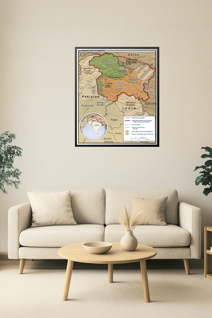
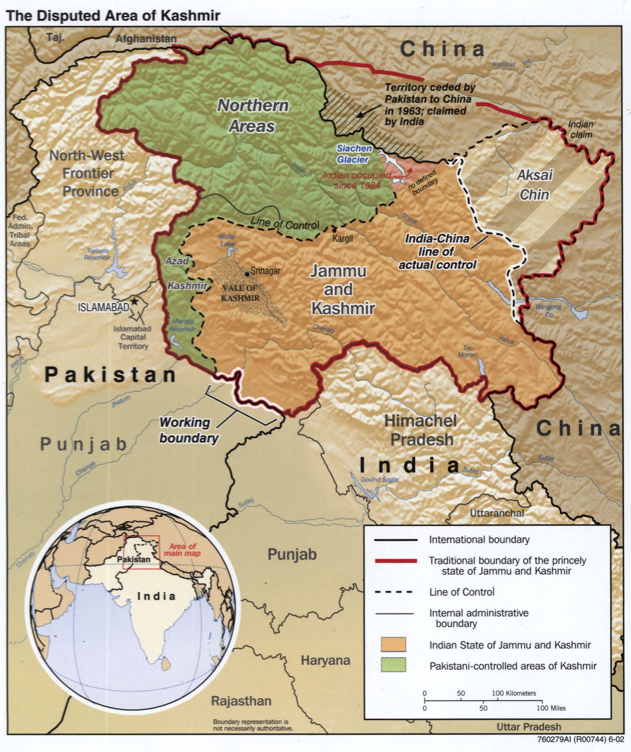
Disputed Kashmir Region Map Poster – Geopolitical Reference
This detailed map poster illustrates the complex territorial claims and control lines in the Kashmir region, including the Line of Control, the India-China Line of Actual Control, Aksai Chin, and areas administered by India, Pakistan, and China. Highlighted boundaries, regions under dispute, and historical claims make this map essential for geopolitical, academic, or educational settings.


Reviews
There are no reviews yet.