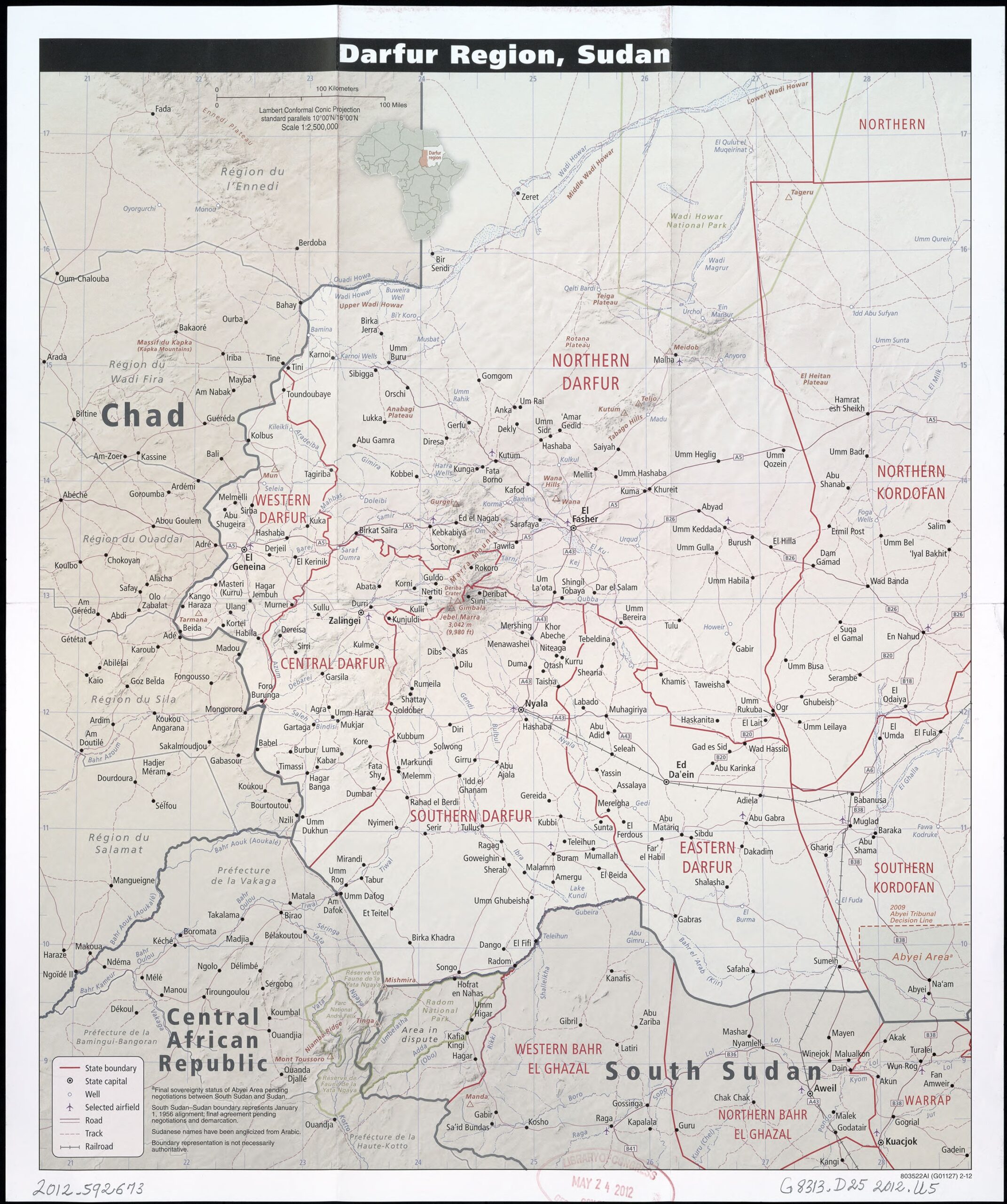
Darfur Region Map Poster – Sudan & Border Areas with Chad, South Sudan, CAR

| Weight | 8 oz |
|---|---|
| Dimensions | 26 × 2 × 2 in |
| Size (inches) | |
| Finishing Options |
Darfur Region Map Poster – Sudan & Border Areas with Chad, South Sudan, CAR
Explore one of Africa’s most geopolitically significant regions with this detailed map of the Darfur region in Sudan. Highlighting Northern, Southern, Eastern, Western, and Central Darfur, this map also includes bordering areas of Chad, South Sudan, and the Central African Republic. Marked with towns, railways, roads, rivers, and airfields, it’s ideal for humanitarian studies, conflict research, academic use, and regional planning.
How to Choose the Right Finish for Your Map

Reviews
There are no reviews yet.