
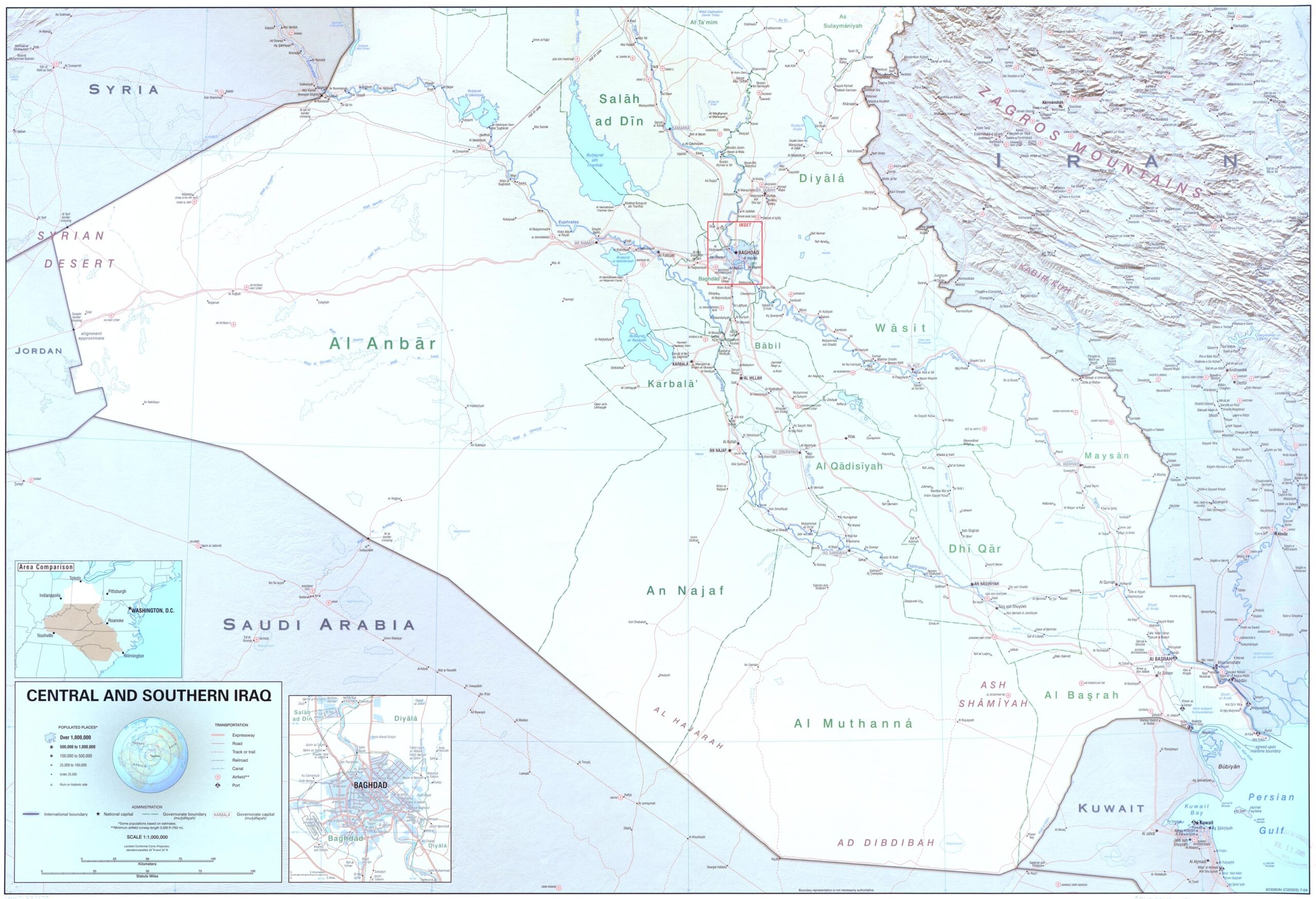

Central and Southern Iraq Map – Detailed Political & Geographical Reference
Explore Central and Southern Iraq with this high-resolution map showing administrative boundaries, rivers, cities, roads, and neighboring countries. Key provinces such as Al Anbar, Baghdad, Al Basrah, Karbala, and Najaf are clearly labeled, alongside major infrastructure and natural landmarks including the Zagros Mountains and the Persian Gulf coastline.


Reviews
There are no reviews yet.