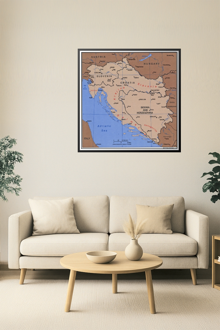
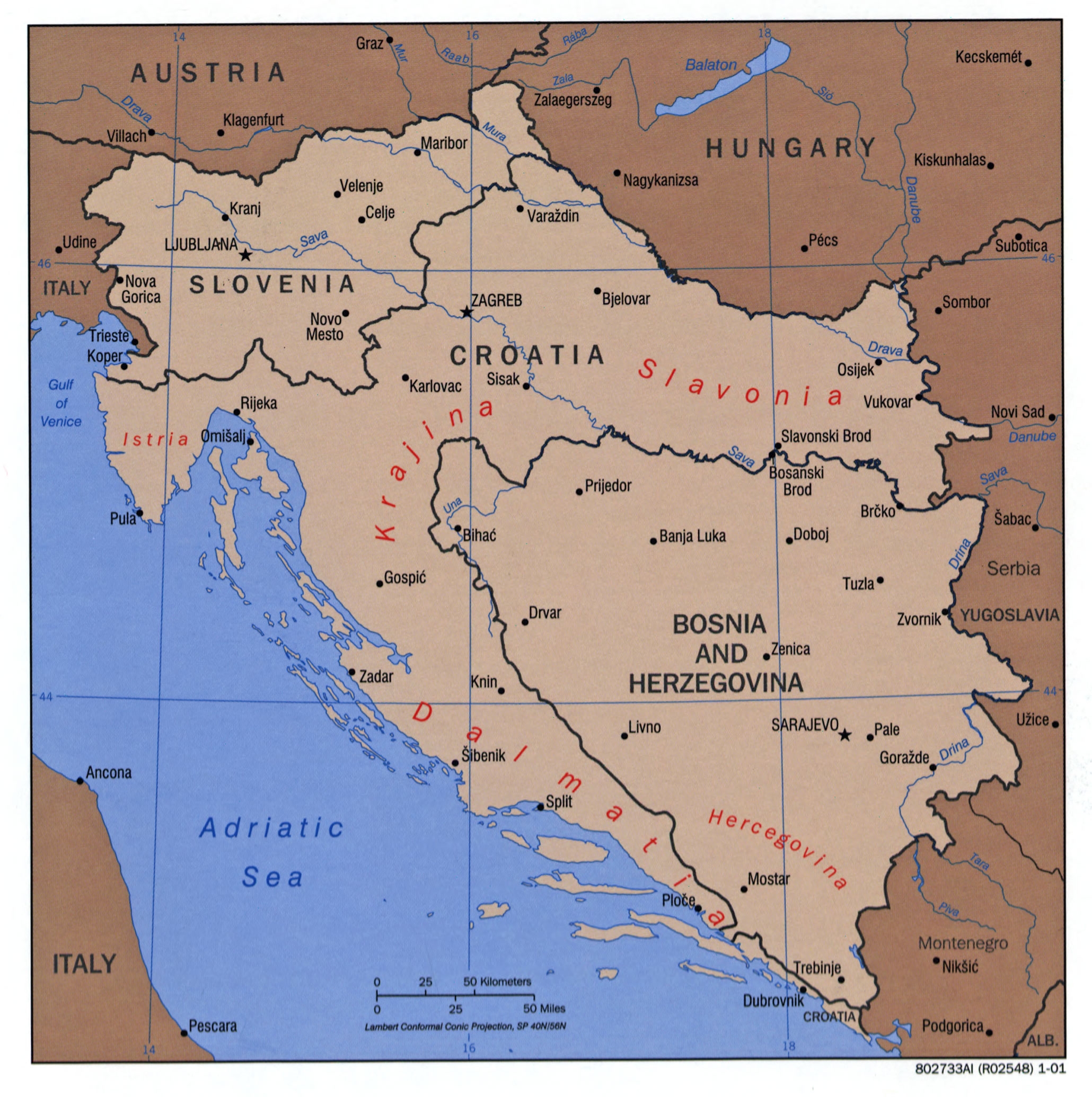
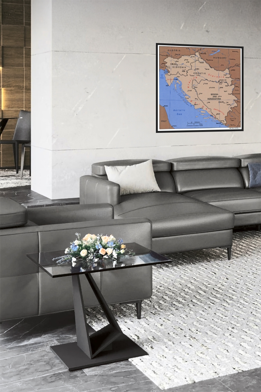
Balkans Historical Map Poster – Croatia, Bosnia, Slovenia & More
| Weight | 8 oz |
|---|---|
| Dimensions | 26 × 2 × 2 in |
| Size (inches) | |
| Finishing Options |
Balkans Historical Map Poster – Croatia, Bosnia, Slovenia & More
Explore the rich geography and historical regions of the Balkans with this detailed map poster. Featuring political boundaries, regional names like Dalmatia, Slavonia, Krajina, and Istria, this map provides valuable insight into the complex past of Southeastern Europe. Ideal for educational, historical, and cultural reference.
How to Choose the Right Finish for Your Map
similar maps


Reviews
There are no reviews yet.