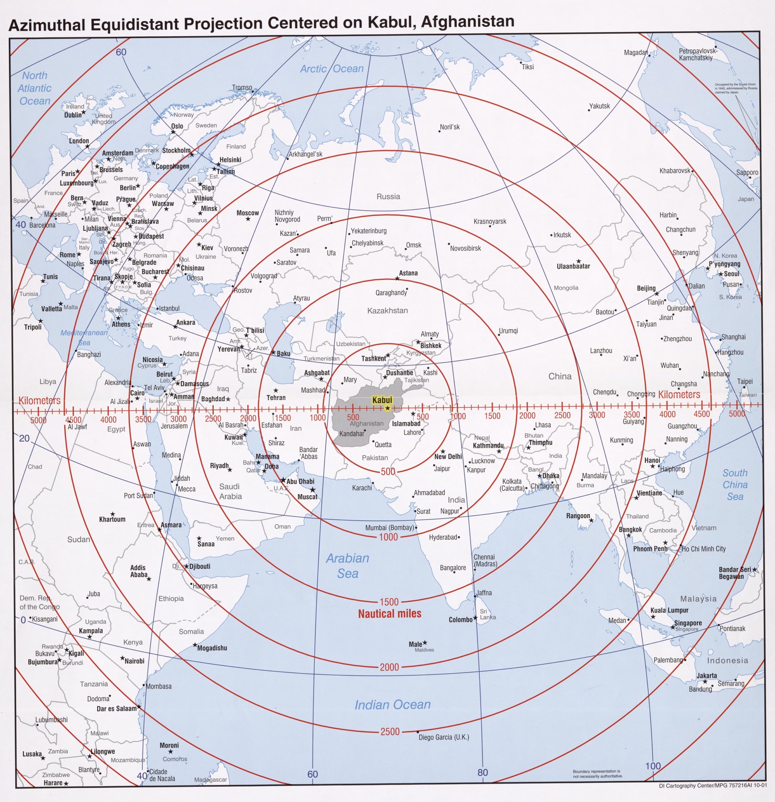
Azimuthal Equidistant Projection Map Centered on Kabul, Afghanistan – Distance Rings Map

| Weight | 8 oz |
|---|---|
| Dimensions | 26 × 2 × 2 in |
| Size (inches) | |
| Finishing Options |
Azimuthal Equidistant Projection Map Centered on Kabul, Afghanistan – Distance Rings Map
This unique map centers on Kabul, Afghanistan, using an Azimuthal Equidistant Projection to show accurate distances in all directions. Concentric rings indicate distances in both kilometers and nautical miles, covering Europe, Asia, the Middle East, and parts of Africa. A valuable visual for understanding regional proximity, military logistics, and geostrategic planning.
How to Choose the Right Finish for Your Map

Reviews
There are no reviews yet.