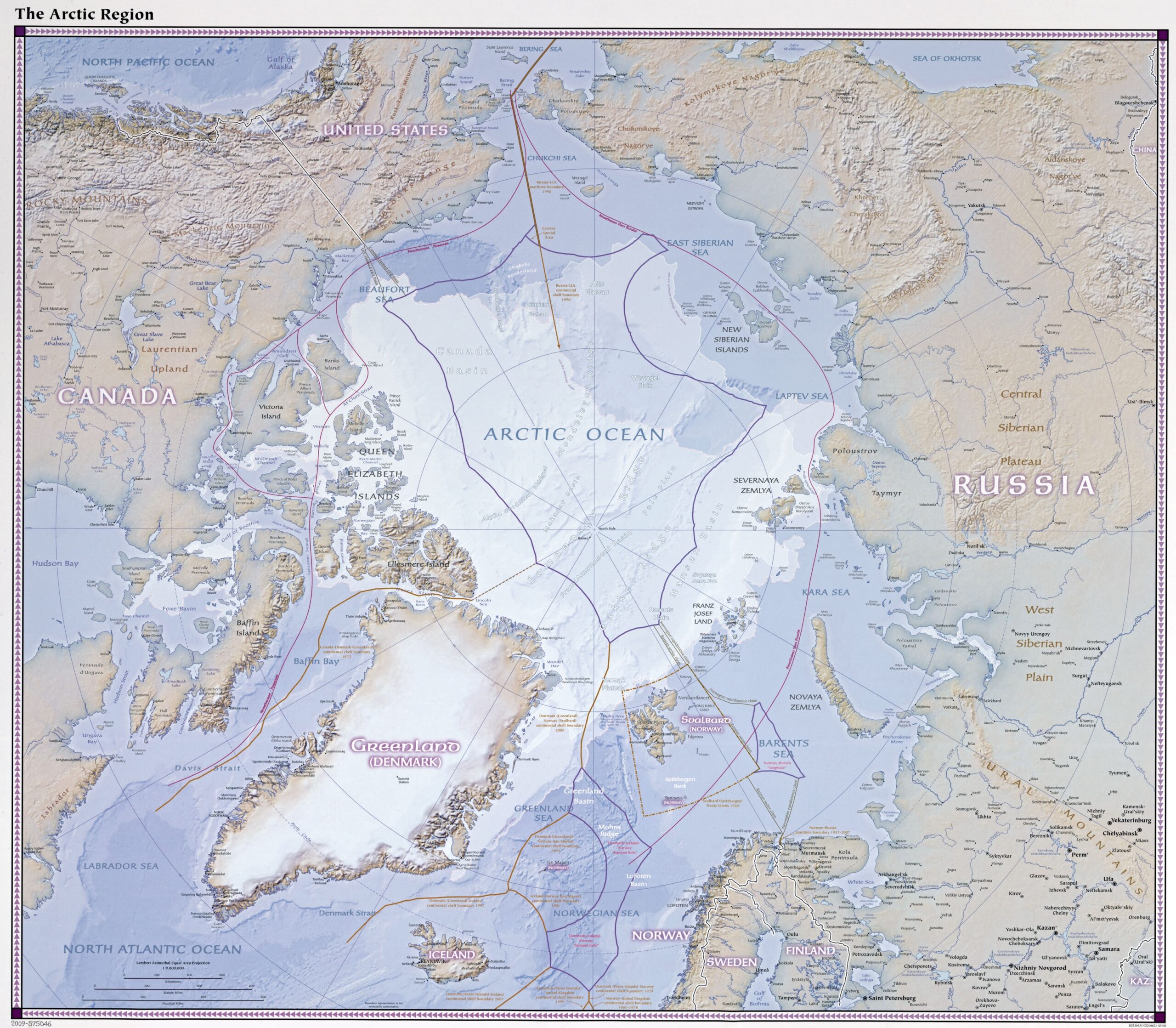
Arctic Region Relief Map Poster – Polar Geography & Oceanic Boundaries
| Weight | 8 oz |
|---|---|
| Dimensions | 26 × 2 × 2 in |
| Size (inches) | |
| Finishing Options |
Arctic Region Relief Map Poster – Polar Geography & Oceanic Boundaries
Explore the northernmost part of our planet with this beautifully shaded relief map of the Arctic Region. Highlighting the Arctic Ocean, territorial claims, seafloor ridges, island groups, and continental shelf lines, this map includes key nations such as Canada, Russia, the United States, Denmark (Greenland), and Norway. Perfect for climate studies, geopolitical reference, polar research, or elegant wall display.
How to Choose the Right Finish for Your Map
similar maps

Reviews
There are no reviews yet.