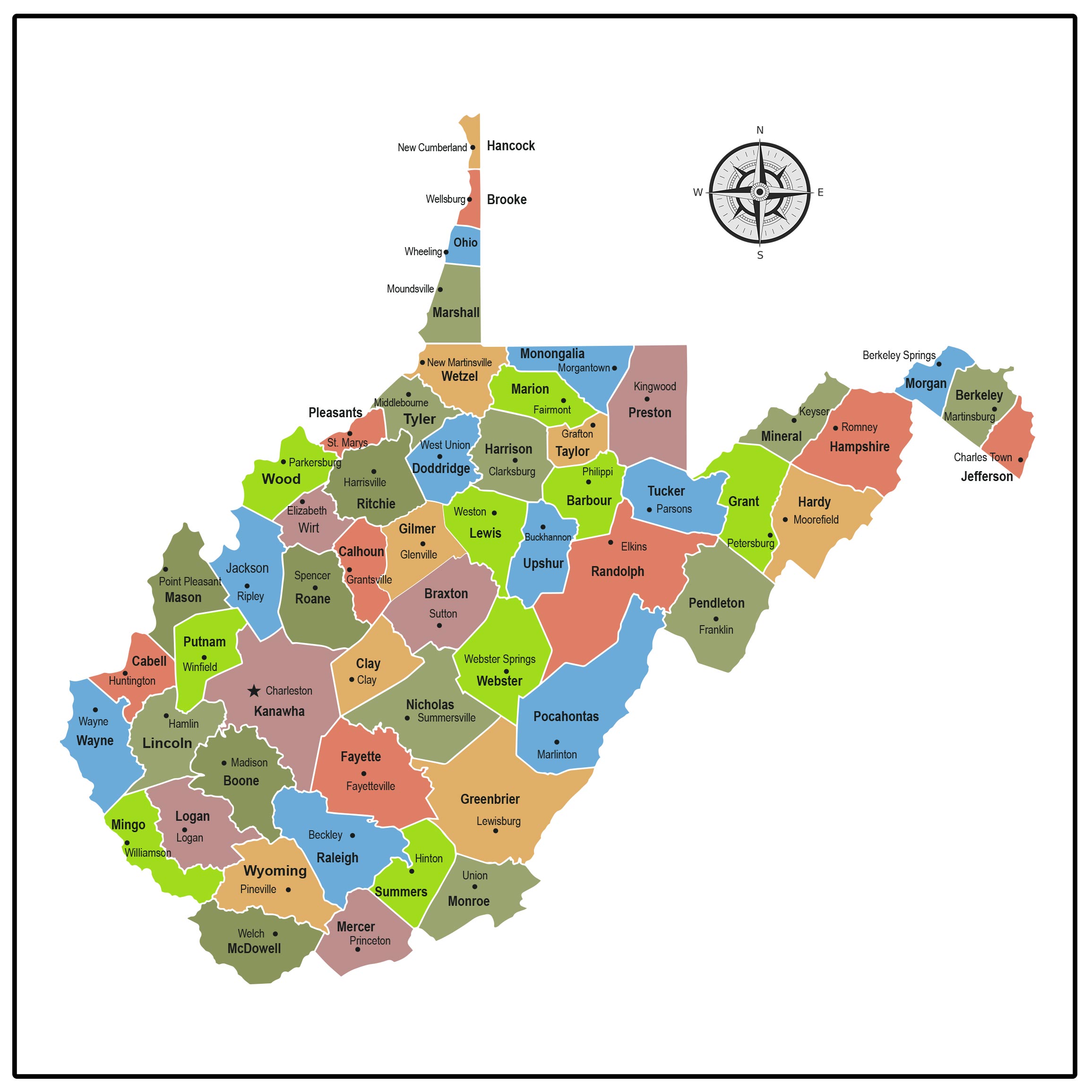
26x24in Poster West Virginia County Map
Shop the Wall Art Impressions collection of wall maps, including country maps, state maps, political maps, physical maps, thematic maps, and more. Designed with meticulous attention to detail, our maps are the perfect addition to any home, office, classroom, or study space. The high-quality printing ensures that every country, continent, or county is accurately represented, making it easy to distinguish boundaries, capitals, major cities, and geographical features. The clear labeling makes them an ideal educational resource for classrooms.

Reviews
There are no reviews yet.