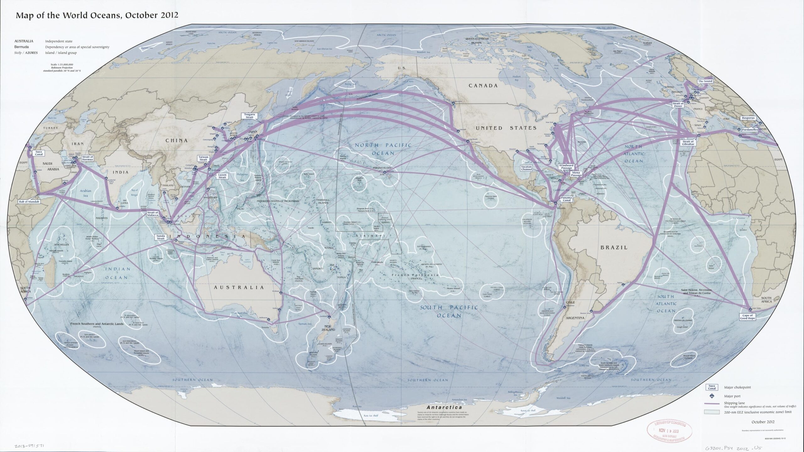
24x42in Poster Map of the World Oceans – Global Shipping Lanes & Ports (2012 Edition)


| Weight | 8 oz |
|---|---|
| Dimensions | 26 × 2 × 2 in |
| Size (inches) | |
| Finishing Options |
24x42in Poster Map of the World Oceans – Global Shipping Lanes & Ports (2012 Edition)
This detailed 2012 World Oceans map showcases global shipping lanes, major ports, exclusive economic zones (EEZs), and international maritime routes. Ideal for educators, oceanographers, or shipping professionals, the map offers a unique look into global trade infrastructure and nautical geography. Includes major chokepoints like the Panama Canal, Strait of Hormuz, and Suez Canal.
How to Choose the Right Finish for Your Map
Reviews
There are no reviews yet.