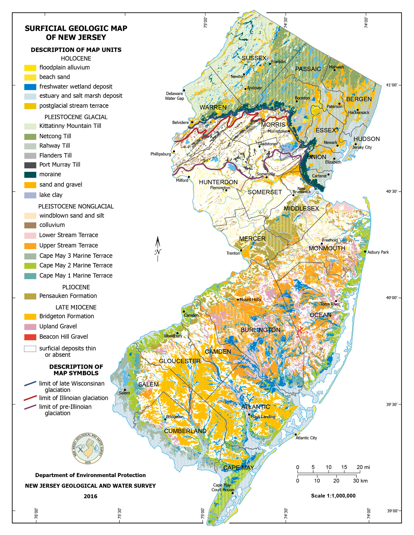
24″x31″ Surficial Geologic Map of New Jersey – New Jersey Geological and Water Survey (2016)
| Weight | 6 oz |
|---|---|
| Dimensions | 26 × 2 × 2 in |
| Finishing Options | |
| Brand Name |
24″x31″ Surficial Geologic Map of New Jersey – New Jersey Geological and Water Survey (2016)
Discover the complex and diverse surface geology of New Jersey with this high-resolution Surficial Geologic Map produced by the New Jersey Geological and Water Survey (2016). This colorful and detailed map displays the distribution of various geologic units across the state, including Holocene floodplain alluvium, Pleistocene glacial tills, marine terraces, and Miocene to Pliocene formations.
Key features include:
-
Detailed color-coded units: sand, gravel, alluvium, till, wetland deposits, and more
-
Glacial boundaries: late Wisconsinan, Illinoian, and pre-Illinoian limits
-
Geological coverage of all New Jersey counties with labeled cities and rivers
-
An essential reference for geologists, educators, planners, and environmental scientists
This map is ideal for understanding the geomorphic history and surficial processes that have shaped New Jersey’s landscape.
How to Choose the Right Finish for Your Map

Reviews
There are no reviews yet.