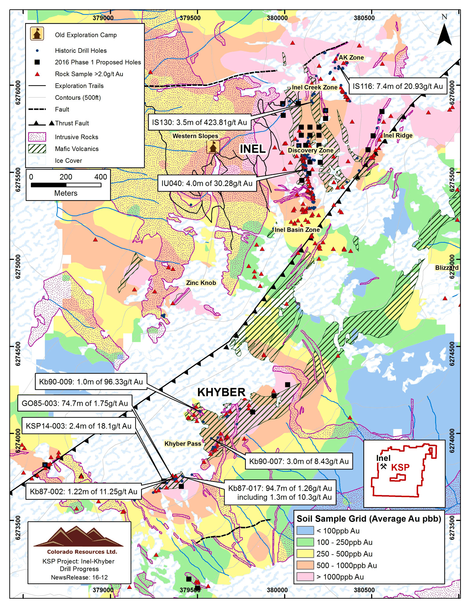
24″x31″ Map KSP Project Drill Progress Map – Inel-Khyber Gold Exploration Zones
| Weight | 6 oz |
|---|---|
| Dimensions | 26 × 2 × 2 in |
| Finishing Options | |
| Brand Name |
24″x31″ Map KSP Project Drill Progress Map – Inel-Khyber Gold Exploration Zones
Explore the detailed geological and exploration layout of the KSP Project by Colorado Resources Ltd., showcasing the Inel and Khyber zones. This high-resolution map highlights historic and 2016 proposed drill holes, major gold sample findings, thrust faults, exploration trails, and significant zones such as the Discovery Zone, Inel Basin Zone, and Khyber Pass. Key assay results, geological formations, and a soil sample grid for gold (Au) concentrations in ppb are clearly marked for geological insight and investor reference.
Perfect for mining analysts, geologists, and investors seeking insights into the mineral potential of the Inel-Khyber region.
How to Choose the Right Finish for Your Map
similar maps

Reviews
There are no reviews yet.