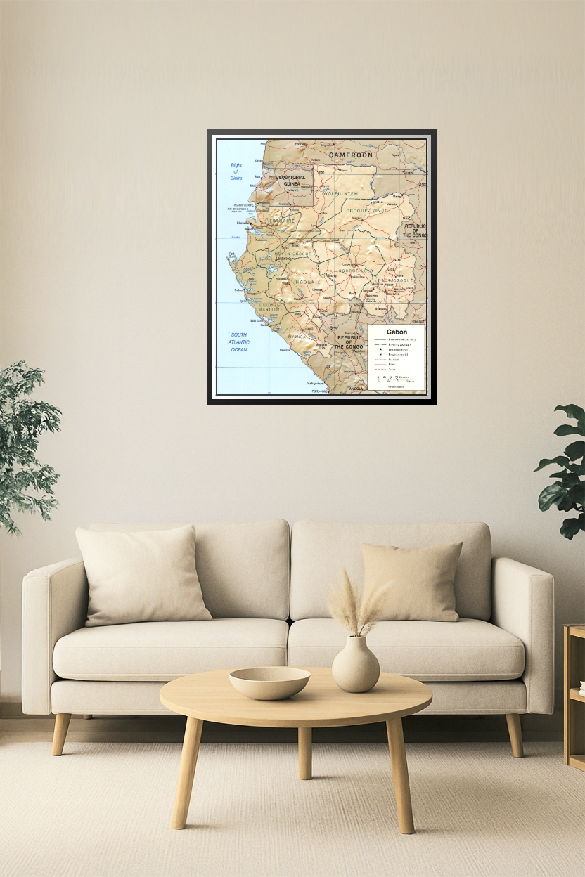
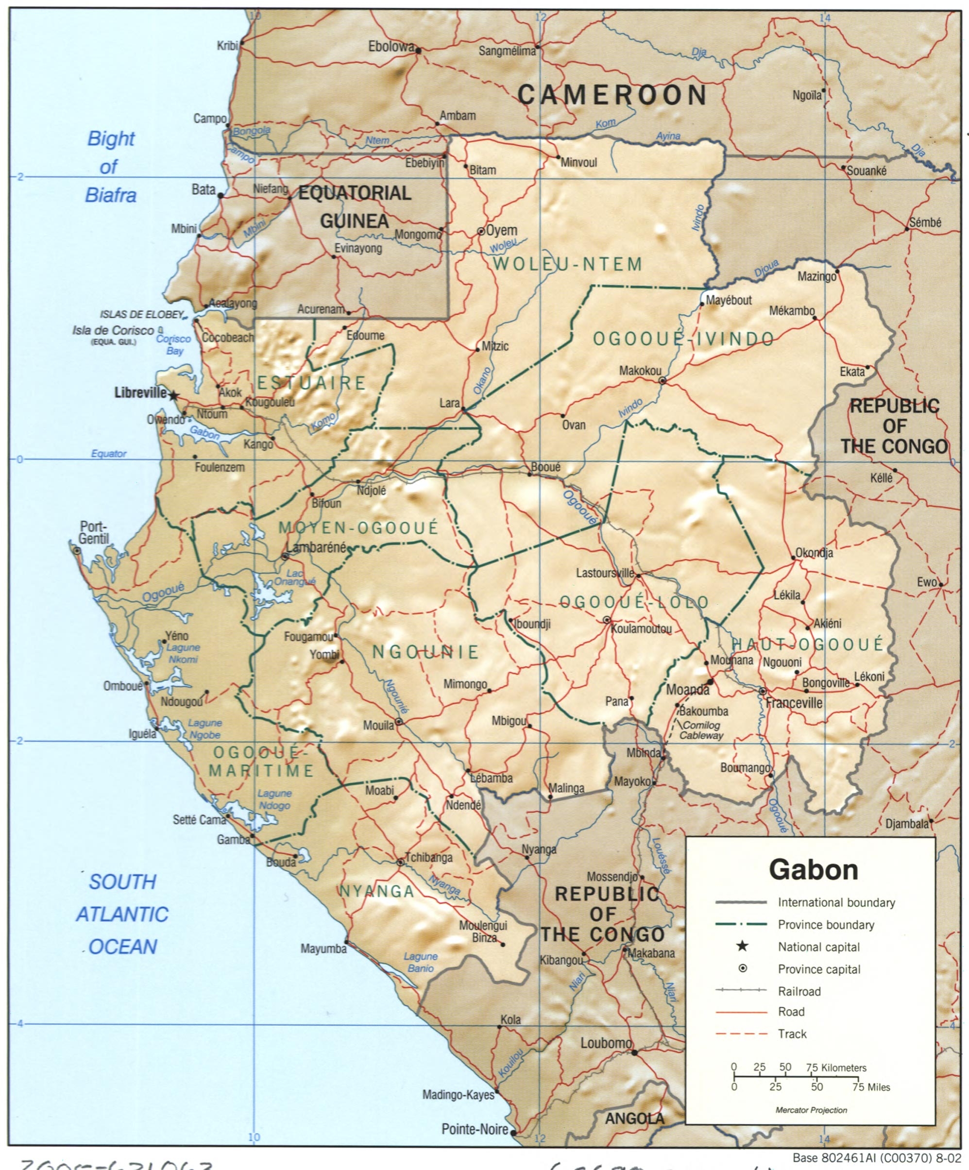

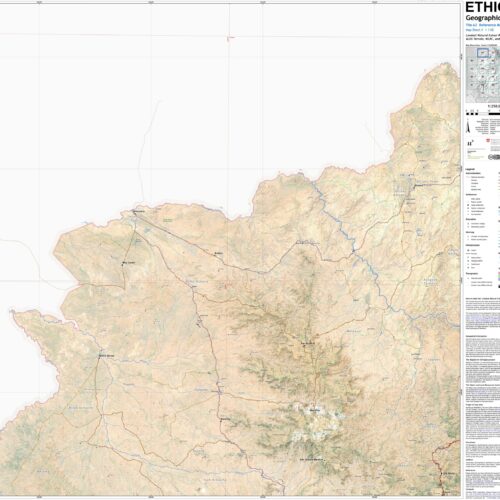
24x28in Poster Gabon Political and Relief Poster – Provinces, Roads, and Terrain Detail
This detailed map of Gabon displays its provincial boundaries, major cities, and transportation infrastructure with physical relief shading. It includes neighboring regions such as Cameroon, Equatorial Guinea, and the Republic of the Congo, offering context for regional understanding. Ideal for educators, travelers, and geopolitical researchers.


Reviews
There are no reviews yet.